La Paloma, Durazno
- Not to be confused with the town La Paloma of Rocha Department
| La Paloma | |
|---|---|
| Village | |
 La Paloma Location in Uruguay | |
| Coordinates: 32°44′0″S 55°35′0″W / 32.73333°S 55.58333°WCoordinates: 32°44′0″S 55°35′0″W / 32.73333°S 55.58333°W | |
| Country |
|
| Department | Durazno Department |
| Population (2011) | |
| • Total | 1,443 |
| Time zone | UTC -3 |
| Postal code | 97004 |
| Dial plan | +598 436 (+5 digits) |
La Paloma is a village in the Durazno Department of central Uruguay.
Location
The village is located 16 kilometres (9.9 mi) into a secondary road that splits off Route 6 in a westward direction at about 78 kilometres (48 mi) north of Sarandí del Yí. A train station of the railroad track from Sarandí del Yí to the north end of the department is 3 kilometres (1.9 mi) east of the village.
History
Its status was elevated to "Pueblo" (village) on 3 May 1984 by the Act of Ley Nº 15.542.[1]
Population
In 2011, it had a population of 1,443.[2]
| Year | Population |
|---|---|
| 1963 | 1,539 |
| 1975 | 1,554 |
| 1985 | 1,242 |
| 1996 | 1,373 |
| 2004 | 1,547 |
| 2011 | 1,443 |
Source: Instituto Nacional de Estadística de Uruguay[3]
Places of worship
- Parish Church of the Sacred Heart (Roman Catholic)
References
- ↑ "Ley Nº 15.542". República Oriental del Uruguay, Poder Legislativo. 1964. Retrieved 3 September 2012.
- ↑ "Censos 2011 Cuadros Durazno". INE. 2012. Retrieved 25 August 2012.
- ↑ "Statistics of urban localities (1963–2004)" (PDF). INE. 2012. Retrieved 7 September 2012.
External links
Capital: Durazno | ||
| Towns and villages | 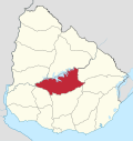 | |
| Sights | ||
This article is issued from Wikipedia - version of the 5/13/2013. The text is available under the Creative Commons Attribution/Share Alike but additional terms may apply for the media files.