Lac-Juillet, Quebec
| Lac-Juillet | |
|---|---|
| Unorganized territory | |
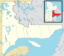 Lac-Juillet Location in Côte-Nord Region of Quebec. | |
| Coordinates: 54°47′N 64°00′W / 54.783°N 64.000°WCoordinates: 54°47′N 64°00′W / 54.783°N 64.000°W[1] | |
| Country |
|
| Province |
|
| Region | Côte-Nord |
| RCM | Caniapiscau |
| Constituted | January 1, 1986 |
| Government[2] | |
| • Federal riding | Manicouagan |
| • Prov. riding | Duplessis |
| Area[2][3] | |
| • Total | 3,545.50 km2 (1,368.93 sq mi) |
| • Land | 3,030.78 km2 (1,170.19 sq mi) |
| Population (2011)[3] | |
| • Total | 26 |
| • Density | 0.0/km2 (0/sq mi) |
| • Pop 2006-2011 |
|
| • Dwellings | 5 |
| Time zone | EST (UTC-5) |
| • Summer (DST) | EDT (UTC-4) |
| Highways | No major routes |
Lac-Juillet is an unorganized territory in the Côte-Nord region of Quebec, Canada, part of Caniapiscau Regional County Municipality.
The eponymous Lake Juillet (54°47′55″N 64°00′31″W / 54.79861°N 64.00861°W) is located in the eastern part of the territory and was named after Blaise Juillet Avignon, a companion of Adam Dollard des Ormeaux, who drowned on April 19, 1660, near Nuns' Island.[4]
Demographics
Population trend:[5]
- Population in 2011: 26
- Population in 2006: 0
- Population in 2001: 0
- Population in 1996: 0
- Population in 1991: 0
References
- ↑ Reference number 149774 of the Commission de toponymie du Québec (French)
- 1 2 Ministère des Affaires municipales, des Régions et de l'Occupation du territoire - Répertoire des municipalités: Lac-Juillet
- 1 2 Statistics Canada 2011 Census - Lac-Juillet census profile
- ↑ "Lac Juillet" (in French). Commission de toponymie du Québec. Retrieved 2010-10-10.
- ↑ Statistics Canada: 1996, 2001, 2006, 2011 census
 |
Rivière-Koksoak | | ||
| Div. No. 10 Subd. D (NL) | |
Div. No. 10 Subd. E (NL) | ||
| ||||
| | ||||
| Div. No. 10 Subd. D (NL) |
| Cities & Towns | |
|---|---|
| Unorganized Territories | |
| Native reserves (Unassociated with RCM) |
|
| Naskapi reserve land (Unassociated with RCM) | |
| |
This article is issued from Wikipedia - version of the 4/21/2013. The text is available under the Creative Commons Attribution/Share Alike but additional terms may apply for the media files.