Lac-Normand, Quebec
| Lac-Normand | |
|---|---|
| Unorganized territory | |
 Location within Mékinac Regional County Municipality. | |
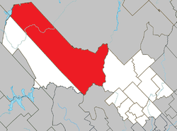
 Lac-Normand Location in central Quebec. | |
| Coordinates: 47°05′N 73°14′W / 47.083°N 73.233°WCoordinates: 47°05′N 73°14′W / 47.083°N 73.233°W[1] | |
| Country |
|
| Province |
|
| Region | Mauricie |
| RCM | Mékinac |
| Constituted | March 13, 1986 |
| Government[2] | |
| • Federal riding | Saint-Maurice—Champlain |
| • Prov. riding | Laviolette |
| Area[2][3] | |
| • Total | 2,171.20 km2 (838.31 sq mi) |
| • Land | 2,038.09 km2 (786.91 sq mi) |
| Population (2011)[3] | |
| • Total | 5 |
| • Density | 0.0/km2 (0/sq mi) |
| • Pop 2006-2011 |
|
| • Dwellings | 33 |
| Time zone | EST (UTC−5) |
| • Summer (DST) | EDT (UTC−4) |
| Highways | No major routes |
Lac-Normand is an unorganized territory in the Mauricie region of Quebec, Canada, part of the Mékinac Regional County Municipality. Most of the territory la "Lac-Normand" is included in the Saint-Maurice Wildlife Reserve.
Toponymy
Like many unorganized territory of Quebec, Lac-Normand refers to a water feature in its territory. Lac Norman is located northwest of the Saint-Maurice Wildlife Reserve. It is also about what the largest lake located camping reserve.[4] Lake commemorates Louis-Philippe Normand (1863-1928), physician and politician, he was mayor of Trois-Rivières, and the first French president of Medical Council of Canada.[5]
Geography
Lake Norman is located 55 km north of Shawinigan and 70 km south of La Tuque. The territory of 2,038.04 kilometres (1,266.38 mi) is located in the Mauricie region and Mékinac Regional County Municipality. This unorganized territory shares its territory with:
- the cities of La Tuque and Shawinigan,
- the municipalities of Trois-Rives and Saint-Alexis-des-Monts and
- unorganized territories of Rivière-de-la-Savane and Baie-Obaoca.
The territory la Lac-Normand is entirely within the Laurentian Mountains. The rock is covered with glacial deposits over a large part of the territory. This area has the shape of a tall boot inclined at 45 degrees to the west, the tip heel toward south and toe to the east.
The entire territory is drained by the basin of Saint-Maurice, which also marks the boundary of the territory. Other rivers draining the area are the rivers Matawin, Wessonneau, Livernois and Vermillion. The area is also dotted with many lakes.
 |
La Tuque | Baie-Obaoca | | |
| Rivière-de-la-Savane | |
Trois-Rives | ||
| ||||
| | ||||
| Saint-Alexis-des-Monts | Shawinigan |
See also
- Saint-Maurice Wildlife Reserve
- Proposed biodiversity reserve Valley-Tousignant (Réserve de biodiversité projetée de la Vallée-Tousignant)
- Zec du Chapeau-de-Paille
- Zec Wessonneau
- Zec du Gros-Brochet
- Mékinac Regional County Municipality
References
- ↑ Reference number 149648 of the Commission de toponymie du Québec (French)
- 1 2 Ministère des Affaires municipales, des Régions et de l'Occupation du territoire - Répertoire des municipalités: Lac-Normand
- 1 2 Statistics Canada 2011 Census - Lac-Normand census profile
- ↑ "Accommodation and camping". Sépaq. Retrieved March 15, 2009.
- ↑ "Topos on the web: Normand". Geographical Names Board. Retrieved March 15, 2009.
| Cities & towns | |
|---|---|
| Municipalities | |
| Parishes | |
| Villages | |
| Unorganized territories | |