Laceyville, Pennsylvania
| Borough of Laceyville | |
| Borough | |
| Country | United States |
|---|---|
| State | Pennsylvania |
| County | Wyoming |
| Elevation | 620 ft (189.0 m) |
| Coordinates | 41°38′43″N 76°09′38″W / 41.64528°N 76.16056°WCoordinates: 41°38′43″N 76°09′38″W / 41.64528°N 76.16056°W |
| Area | 0.2 sq mi (0.5 km2) |
| - land | 0.2 sq mi (1 km2) |
| - water | 0.0 sq mi (0 km2), 0% |
| Population | 379 (2010) |
| Density | 1,895/sq mi (731.7/km2) |
| Mayor | Ken Patton |
| Timezone | EST (UTC-5) |
| - summer (DST) | EDT (UTC-4) |
| ZIP Code | 18623 |
| Area code | 570 Exchange: 869 |
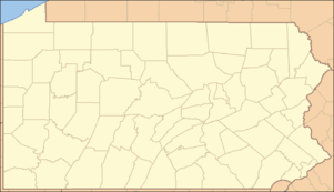 Location of Laceyville in Pennsylvania | |
 Location of Pennsylvania in the United States | |
| Website: http://www.laceyville.com | |
Laceyville is a borough in Wyoming County, Pennsylvania, United States. The population was 379 at the 2010 census.
Geography
Laceyville is located at 41°38′43″N 76°9′38″W / 41.64528°N 76.16056°W (41.645337, -76.160451).[1]
According to the United States Census Bureau, the borough has a total area of 0.2 square miles (0.52 km2), all of it land.
Demographics
| Historical population | |||
|---|---|---|---|
| Census | Pop. | %± | |
| 1910 | 479 | — | |
| 1920 | 466 | −2.7% | |
| 1930 | 467 | 0.2% | |
| 1940 | 491 | 5.1% | |
| 1950 | 505 | 2.9% | |
| 1960 | 468 | −7.3% | |
| 1970 | 452 | −3.4% | |
| 1980 | 498 | 10.2% | |
| 1990 | 436 | −12.4% | |
| 2000 | 396 | −9.2% | |
| 2010 | 379 | −4.3% | |
| Est. 2015 | 364 | [2] | −4.0% |
| Sources:[3][4][5] | |||
At the 2000 census,[6] there were 379 people, 160 households and 102 families residing in the borough. The population density was 1,895 per square mile (731.7/km²). There were 185 housing units at an average density of 925 per square mile (361.3/km²). The racial makeup of the borough was 94.5% White, 0.5% African American, 4.7% some other race, and 0.3% from two or more races. Hispanic or Latino of any race were 7.9% of the population.
There were 160 households of which 32.5% had children under the age of 18 living with them, 44.4% were married couples living together, 13.1% had a female householder with no husband present, and 36.3% were non-families. 32.5% of all households were made up of individuals and 12.5% had someone living alone who was 65 years of age or older. The average household size was 2.37 and the average family size was 2.89.
23.7% of the population were under the age of 18, 61.8% from 18 to 64, and 14.5% who were 65 years of age or older. The median age was 39.4 years.
The median household income was $46,667 and the median family income was $58,542. Males had a median income of $32,125 and females $25,000. The per capita income was $18,594. About 14.4% of families and 15.1% of the population were below the poverty line, including 22.6% of those under age 18 and 18.2% of those age 65 or over.
References
- ↑ "US Gazetteer files: 2010, 2000, and 1990". United States Census Bureau. 2011-02-12. Retrieved 2011-04-23.
- ↑ "Annual Estimates of the Resident Population for Incorporated Places: April 1, 2010 to July 1, 2015". Retrieved July 2, 2016.
- ↑ "Census of Population and Housing". U.S. Census Bureau. Retrieved 11 December 2013.
- ↑ "American FactFinder". United States Census Bureau. Retrieved 2008-01-31.
- ↑ "Incorporated Places and Minor Civil Divisions Datasets: Subcounty Resident Population Estimates: April 1, 2010 to July 1, 2012". Population Estimates. U.S. Census Bureau. Retrieved 11 December 2013.
- ↑ "American FactFinder". United States Census Bureau. Retrieved 2011-05-14.
External links
{{US county navigation box | county =Wyoming County | state =Pennsylvania | template_name =Wyoming County, Pennsylvania | listclass =hlist | map_image =Map of Pennsylvania highlighting Wyoming County.svg | map_caption = | seat =Tunkhannock
| title1 =Boroughs | body1 =
| title2 =Townships | body2 =
- Braintrim
- Clinton
- Eaton
- Exeter
- Falls
- Forkston
- Lemon
- Mehoopany
- Meshoppen
- Monroe
- Nicholson
- North Branch
- Northmoreland
- Noxen
- Overfield
- Tunkhannock
- Washington
- Windham
| title3 =CDPs | body3 =
- Lake Winola
- Noxen
- West Falls
- [[Stull, Pennsylvania https://en.wikipedia.org/wiki/Stull,_Pennsylvania
| title4 =Ghost town | body4 =
}}