Lansing, New York
| Lansing | |
|---|---|
| Town | |
 Lansing Location within the state of New York | |
| Coordinates: 42°33′57″N 076°31′55″W / 42.56583°N 76.53194°WCoordinates: 42°33′57″N 076°31′55″W / 42.56583°N 76.53194°W | |
| Country | United States |
| State | New York |
| County | Tompkins |
| Incorporated | 1817 |
| Area | |
| • Total | 69.9 sq mi (181.1 km2) |
| • Land | 60.7 sq mi (157.3 km2) |
| • Water | 9.2 sq mi (23.9 km2) 13.17%% |
| Elevation | 1,690 ft (515 m) |
| Population (2010) | |
| • Total | 11,033 |
| • Density | 160/sq mi (61/km2) |
| Time zone | Eastern (EST) (UTC-5) |
| • Summer (DST) | EDT (UTC-4) |
| ZIP code | 14882 |
| Area code(s) | 315, 607 |
| FIPS code | 36-41234 |
| GNIS feature ID | 955042 |
| Website |
www |
Lansing (/ˈlænsɪŋ/) is a town in Tompkins County, New York, United States. The population was 11,033 at the 2010 census. The town is named after John Lansing. Settlers from Lansing were early residents of the then-township of Lansing, Michigan and named it after their hometown; it would later become a city and the capital of Michigan.
The Town of Lansing has within it a village named Lansing. The town is on the north border of the county, north of the City of Ithaca. The Lansing Star Online is Lansing's free weekly online newspaper that covers Lansing's news, weather, sports, business, arts and entertainment. http://www.lansingstar.com/
In December 2014, the Lansing Town Board unanimously adopted a resolution recognizing freedom from domestic violence as a fundamental human right.[1]
History
Lansing, located on the Eastern shore of Cayuga Lake in the Finger Lakes district of New York, is known best as a small town close to Ithaca, New York. Lansing was within the realm of the Cayuga tribe. The Sullivan Expedition of 1779 passed through the area to destroy native villages in retaliation for raids on colonists.
In 1760, the area was divided into lots (the Central New York Military Tract) to pay the Revolutionary war soldiers for their service. The first settlers came to Lansing in 1764. John Lemming, Jr., secretary to General Schuyler, was charged with granting this land. The Town of Lansing was formed in 1817 from the Town of Genoa, Cayuga County, when Tompkins County was founded.
From 1942, the Watchtower Bible College of Gilead was in South Lansing, established to train Christian Missionaries from Jehovah's Witnesses until 1960. Later the name was changed to the Watchtower Bible School of Gilead and moved to New York City. The Rogues' Harbor Inn was listed on the National Register of Historic Places in 2009.[2]
Geography
According to the United States Census Bureau, the town has a total area of 69.9 square miles (181.1 km²), of which, 60.7 square miles (157.3 km²) of it is land and 9.2 square miles (23.9 km²) of it (13.17%) is water.
The north town line is the border of Cayuga County, and the west town line is delineated by Cayuga Lake, one of the Finger Lakes. Salmon Creek flows into the lake near Myers.
Demographics
| Historical population | |||
|---|---|---|---|
| Census | Pop. | %± | |
| 1820 | 3,631 | — | |
| 1830 | 4,020 | 10.7% | |
| 1840 | 3,672 | −8.7% | |
| 1850 | 3,318 | −9.6% | |
| 1860 | 3,222 | −2.9% | |
| 1870 | 2,874 | −10.8% | |
| 1880 | 3,000 | 4.4% | |
| 1890 | 2,505 | −16.5% | |
| 1900 | 2,550 | 1.8% | |
| 1910 | 2,676 | 4.9% | |
| 1920 | 2,380 | −11.1% | |
| 1930 | 2,720 | 14.3% | |
| 1940 | 2,786 | 2.4% | |
| 1950 | 3,195 | 14.7% | |
| 1960 | 4,221 | 32.1% | |
| 1970 | 5,972 | 41.5% | |
| 1980 | 8,317 | 39.3% | |
| 1990 | 9,296 | 11.8% | |
| 2000 | 10,521 | 13.2% | |
| 2010 | 11,033 | 4.9% | |
| Est. 2015 | 11,524 | [3] | 4.5% |
As of the census[5] of 2000, there were 10,521 people, 4,374 households, and 2,668 families residing in the town. The population density was 173.3 people per square mile (66.9/km²). There were 4,634 housing units at an average density of 76.3 per square mile (29.5/km²). The racial makeup of the town was 84.09% White, 4.09% Black or African American, 0.19% Native American, 8.86% Asian, 0.04% Pacific Islander, 0.73% from other races, and 2.01% from two or more races. Hispanic or Latino of any race were 2.35% of the population.
There were 4,374 households out of which 30.0% had children under the age of 18 living with them, 50.3% were married couples living together, 7.6% had a female householder with no husband present, and 39.0% were non-families. 30.6% of all households were made up of individuals and 6.8% had someone living alone who was 65 years of age or older. The average household size was 2.33 and the average family size was 2.95.
In the town the population was spread out with 26.1% under the age of 18, 7.7% from 18 to 24, 32.7% from 25 to 44, 23.5% from 45 to 64, and 10.1% who were 65 years of age or older. The median age was 35 years. For every 100 females there were 99.8 males. For every 100 females age 18 and over, there were 94.6 males.
The median income for a household in the town was $48,250, and the median income for a family was $59,758. Males had a median income of $38,146 versus $31,250 for females. The per capita income for the town was $25,634. About 4.2% of families and 6.7% of the population were below the poverty line, including 5.1% of those under age 18 and 3.1% of those age 65 or over.
Communities and locations in the Town of Lansing
- Asbury – A hamlet north of Lansing village.
- Buck Corners – A location south of Lansingville.
- Dublin Corners – A location north of South Lansing.
- East Lansing – A location near the east town line.
- Head Corners – A hamlet east of Asbury.
- Howland Corners – A hamlet on the east town line.
- Howser Corners – A location south of North Lansing.
- Ithaca-Tompkins Regional Airport (ITH) – The airport serving the Ithaca area is northeast of Lansing village in the south part of the town.
- Lake Ridge – A hamlet on NY-34B in the northwest part of Lansing.
- Lake Ridge Point – A projection into Lake Cayuga in the northwest part of Lansing.
- Lansing – The Village of Lansing is near the south town line on NY-13.
- Lansing Residential Center – A New York medium security correctional facility for girls.
- Lansing Station – A location near the shore of Lake Cayuga.
- Lansingville – A hamlet in the northwest part of the town.
- Ludlowville – A hamlet northwest of South Lansing.
- McKinneys – A hamlet near the shore of Cayuga Lake and on NY-34 in the southwest corner of Lansing.
- Midway – A hamlet on NY-34, north of Terpening Corners.
- Munson Corners – A location near the east town line.
- Myers – A hamlet west of South Lansing.
- Norten – A hamlet on the shore of Cayuga Lake north of Portland.
- North Lansing – A hamlet on NY-34 in the northeast corner of the town.
- Portland – A hamlet on the shore of Cayuga Lake by Portland Point.
- Portland Point – A projection into Cayuga Lake in the southwest part of Lansing.
- Rogues Harbor – A former section of the town known for thievery and misbehavior.
- Smith Corners – A location on the east town line.
- South Lansing – A hamlet at the junction of NY-34 and NY-34B in the western part of the town.
- Terpening Corners – A hamlet east of South Lansing by NY-34.
References
- ↑ "Lansing Condemns Domestic Violence". The Lansing Star. Retrieved 23 January 2015.
- ↑ "National Register of Historic Places". WEEKLY LIST OF ACTIONS TAKEN ON PROPERTIES: 8/24/09–8/28/09. National Park Service. 2010-09-04.
- ↑ "Annual Estimates of the Resident Population for Incorporated Places: April 1, 2010 to July 1, 2014". Retrieved June 4, 2015.
- ↑ "Census of Population and Housing". Census.gov. Retrieved June 4, 2015.
- ↑ "American FactFinder". United States Census Bureau. Retrieved 2008-01-31.
External links
Municipalities and communities of Tompkins County, New York, United States | ||
|---|---|---|
| City | 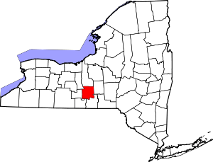 | |
| Towns | ||
| Villages | ||
| CDPs | ||
| Other hamlets | ||