Lapoint, Utah
| Lapoint | |
|---|---|
| Unincorporated community | |
 Lapoint Location within the state of Utah | |
| Coordinates: 40°24′14″N 109°47′37″W / 40.40389°N 109.79361°WCoordinates: 40°24′14″N 109°47′37″W / 40.40389°N 109.79361°W | |
| Country | United States |
| State | Utah |
| County | Uintah |
| Named for | Southward "point" of the Uinta Mountains |
| Elevation | 5,568 ft (1,697 m) |
| Time zone | Mountain (MST) (UTC-7) |
| • Summer (DST) | MDT (UTC-6) |
| ZIP codes | 84039 |
| GNIS feature ID | 1429476[1] |
| Historical population | |||
|---|---|---|---|
| Census | Pop. | %± | |
| 1930 | 579 | — | |
| 1940 | 646 | 11.6% | |
| 1950 | 496 | −23.2% | |
| Source: U.S. Census Bureau[2] | |||
Lapoint is an unincorporated community in western Uintah County, Utah, United States, on the Uintah and Ouray Indian Reservation. It lies along State Route 121 west of the city of Vernal, the county seat of Uintah County.[3] Its elevation is 5,568 feet (1,697 m).[1] Although Lapoint is unincorporated, it has a post office, with the ZIP code of 84039.[4] Originally named Taft in honor of William Howard Taft, its name was changed to Lapoint since it lies on a southward-jutting spur or "point" of the Uinta Mountains.[5]
Climate
According to the Köppen Climate Classification system, Lapoint has a semi-arid climate, abbreviated "BSk" on climate maps.[6]
References
- 1 2 "Lapoint, Utah". Geographic Names Information System. United States Geological Survey. Retrieved 2008-04-12.
- ↑ "Census of Population and Housing". U.S. Census Bureau. Retrieved November 4, 2011.
- ↑ Rand McNally. The Road Atlas '08. Chicago: Rand McNally, 2008, p. 103.
- ↑ Zip Code Lookup
- ↑ Van Cott, John W. (1990). Utah Place Names. Salt Lake City, Utah: University of Utah Press. p. 222. ISBN 0-87480-345-4.
- ↑ Climate Summary for Lapoint, Utah
Municipalities and communities of Uintah County, Utah, United States | ||
|---|---|---|
| Cities | 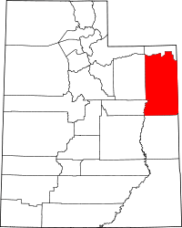 | |
| Town | ||
| CDPs | ||
| Unincorporated communities | ||
| Indian reservation | ||
| Ghost town | ||
| Footnotes | ‡This populated place also has portions in an adjacent county or counties | |
This article is issued from Wikipedia - version of the 9/15/2014. The text is available under the Creative Commons Attribution/Share Alike but additional terms may apply for the media files.