Laurentides
| Laurentides | |
|---|---|
| Administrative region | |
 | |
| Coordinates: 46°26′N 74°59′W / 46.433°N 74.983°WCoordinates: 46°26′N 74°59′W / 46.433°N 74.983°W | |
| Country |
|
| Province |
|
| Regional County Municipalities (RCM) and Equivalent Territories (ET) | |
| Government | |
| • Regional conference of elected officers | Ramez Ayoub (President) |
| Area[1] | |
| • Land | 20,560 km2 (7,940 sq mi) |
| Population (2011)[1] | |
| • Total | 555,614 |
| • Density | 27.02/km2 (70.0/sq mi) |
| Demonym(s) | Laurentien(ne) |
| Time zone | EST (UTC-5) |
| • Summer (DST) | EDT (UTC-4) |
| Postal code | J |
| Area code | 450, 579 |
| Website |
www |
| [1] | |
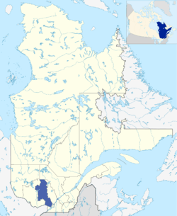
The Laurentides (French pronunciation: [lɔʁɑ̃tid]) is a region of Quebec. While it is often called the Laurentians in English, the region includes only part of the Laurentian mountains. It has a total land area of 20,744.29 km2 (8,009.42 sq mi) and a 2011 census population of 555,614 inhabitants.
The area was inhabited by the Montagnais First Nations tribe, until the French settled it in the first half of the 19th century, establishing an agricultural presence throughout the valleys. During the 20th century, the area also became a popular tourist destination, based on a cottage and lake culture in the summer, and a downhill and cross-country ski culture in the winter. Ski resorts include Saint-Sauveur and Mont Tremblant.
The Laurentides still offer a weekend escape for Montrealers and tourists from New England to Ontario, though with the building of a major highway through the area in the 1970s (Autoroute 15), the area has experienced a lot of growth. Its largest city is Saint-Jérôme, in its extreme southeast, with a 2011 census population of 68,456 inhabitants.
Subdivisions
Regional County Municipalities
| Regional County Municipality (RCM) | Population Canada 2011 Census[2] |
Land Area | Density (pop. per km2) |
Seat of RCM |
|---|---|---|---|---|
| Antoine-Labelle | 35,159 | 14,969.05 km2 (5,779.58 sq mi) | 2.3 | Mont-Laurier |
| Argenteuil | 32,117 | 1,251.64 km2 (483.26 sq mi) | 25.7 | Lachute |
| Deux-Montagnes | 95,670 | 243.39 km2 (93.97 sq mi) | 393.1 | Saint-Eustache |
| La Rivière-du-Nord | 115,165 | 451.06 km2 (174.16 sq mi) | 255.3 | Saint-Jérôme |
| Les Laurentides | 45,157 | 2,478.67 km2 (957.02 sq mi) | 18.2 | Saint-Faustin–Lac-Carré |
| Les Pays-d'en-Haut | 40,331 | 685.41 km2 (264.64 sq mi) | 58.8 | Sainte-Adèle |
| Mirabel (Equivalent Territory) | 41,957 | 485.59 km2 (187.49 sq mi) | 86.4 | Mirabel[3] |
| Thérèse-De Blainville | 151,144 | 206.33 km2 (79.66 sq mi) | 747.1 | Bois-des-Filion |
Indian Reserve
Major communities
See also
References
- 1 2 3 "La région des Laurentides, ainsi que ses MRC et TE". Profils des régions et des MRC (in French). Quebec: Institut de la statistique du Québec. 2011. Retrieved 26 June 2012.
- ↑ "Population and dwelling counts, for Canada, provinces and territories, and census divisions, 2011 and 2006 censuses". Canada 2011 Census. Statistics Canada. 2012-04-11. Retrieved 14 August 2013.
- ↑ (Mirabel is both a City and a territory equivalent to a regional county municipality)
External links
| Wikimedia Commons has media related to Laurentides. |
- Portail régional des Laurentides Portail régional des Laurentides
- Tourisme Laurentides Official website — Site Officiel
- CRÉ
| Subdivisions | |
|---|---|
| Communities | |
| Major cities | |
| Regions | |