Centre-du-Québec
| Centre-du-Québec | |
|---|---|
| Region | |
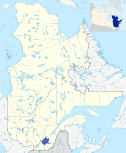 Map of Centre-du-Québec in relation to Quebec. | |
| Coordinates: 46°17′N 72°04′W / 46.283°N 72.067°WCoordinates: 46°17′N 72°04′W / 46.283°N 72.067°W | |
| Country |
|
| Province |
|
| Government | |
| • Regional conference of elected officers | Lionel Fréchette (President) |
| Area | |
| • Total | 6,928.78 km2 (2,675.22 sq mi) |
| Population (2006) | |
| • Total | 224,200 |
| • Density | 32.4/km2 (84/sq mi) |
| Website | www.centreduquebec.gouv.qc.ca |
Centre-du-Québec (French pronunciation: [sɑ̃tʁ dy kebɛk], Central Quebec) is a region of Quebec, Canada. The main centres are Drummondville, Victoriaville and Bécancour. It has a land area of 6,928.78 km² (2,675.22 sq mi) and a 2006 census population of 224,200 inhabitants.
Description
The Centre-du-Québec region was established as an independent administrative region of Quebec on July 30, 1997 (in effect August 20 upon publication in the Gazette officielle du Québec); prior to this date, it formed the southern portion of the Mauricie–Bois-Francs region (the northern part of which is now known simply as Mauricie).[1]
Contrary to its name, Centre-du-Québec is not located in the centre of Quebec, but in the south. Some consider the name Bois-Francs to be synonymous with the Centre-du-Québec region; others see it as being synonymous with Arthabaska Regional County Municipality, with its main city Victoriaville earning the title Capitale des Bois-Francs (capital of the Bois-Francs).
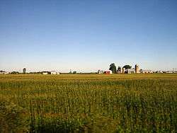
The Centre-du-Québec is a primarily agricultural region known as the breadbasket of Quebec; major products include livestock and poultry, dairy products, as well as food crops such as cereals, vegetables, and fruits such as apples and cranberries. Forestry is also a major industry; the name "Bois-Francs" refers to the French term for hardwood, referring to the high density of hardwood forests in the area. Other major industries of the area include transportation, recycling, woodworking and cabinetmaking.
The Centre-du-Québec region derives great benefit from its central location; major centres such as Montreal and Quebec City are within an hour and a half's drive, while secondary centres such as Sherbrooke and Trois-Rivières are close at hand.
Subdivision
Regional County Municipalities
| Regional County Municipality (RCM) | Population Canada 2011 Census[2] |
Land Area | Density (pop. per km2) |
Seat of RCM |
|---|---|---|---|---|
| Arthabaska | 69,237 | 1,889.80 km2 (729.66 sq mi) | 36.6 | Victoriaville |
| Bécancour | 20,081 | 1,144.67 km2 (441.96 sq mi) | 17.5 | Bécancour |
| Drummond | 98,681 | 1,600.62 km2 (618.00 sq mi) | 61.7 | Drummondville |
| L'Érable | 23,366 | 1,286.81 km2 (496.84 sq mi) | 18.2 | Plessisville |
| Nicolet-Yamaska | 22,798 | 1,007.83 km2 (389.13 sq mi) | 22.6 | Nicolet |
Native Reserves
The Centre-du-Québec region is home to several thousand members of the Wabanaki Nation. They are scattered throughout the region, with two major population centres:
Major communities
- Bécancour
- Drummondville
- Kingsey Falls
- Nicolet
- Plessisville
- Princeville
- Saint-Cyrille-de-Wendover
- Saint-Germain-de-Grantham
- Victoriaville
- Warwick
Highways
Main highways in the region include:
See also
References
- ↑ "Modifications aux municipalités du Québec" (PDF). Bureau de la statistique du Québec. August 1997. ISSN 0843-8250. Retrieved 2012-05-20.
- ↑ "Population and dwelling counts, for Canada, provinces and territories, and census divisions, 2011 and 2006 censuses". Canada 2011 Census. Statistics Canada. 2012-04-11. Retrieved 14 August 2013.
External links
| Wikimedia Commons has media related to Centre-du-Québec. |
- (French) Centre-du-Québec official website
- (French) Centre-du-Québec government portal
- Centre-du-Québec tourist site
- (French) Toile Jeunesse, a regional youth-oriented portal
- "Map of the Centre-du-Québec region" (PDF). Archived from the original (PDF) on 2007-08-09. (2.12 MiB)
- (French) CRÉ|
| Regional county municipalities and equivalent territories | |
|---|---|
| Municipalities | |
| Subdivisions | |
|---|---|
| Communities | |
| Major cities | |
| Regions | |