Le Thillot
For the commune in the Meuse département, see Thillot.
| Le Thillot | ||
|---|---|---|
|
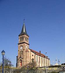
Saint-Jean-Baptiste | ||
| ||
 Le Thillot | ||
|
Location within Grand Est region  Le Thillot | ||
| Coordinates: 47°52′51″N 6°45′57″E / 47.8808°N 6.7658°ECoordinates: 47°52′51″N 6°45′57″E / 47.8808°N 6.7658°E | ||
| Country | France | |
| Region | Grand Est | |
| Department | Vosges | |
| Arrondissement | Épinal | |
| Canton | Le Thillot | |
| Intercommunality | Mynes et Hautes-Vosges du sud | |
| Government | ||
| • Mayor (2008–2014) | Yves Cérésa | |
| Area1 | 15.14 km2 (5.85 sq mi) | |
| Population (2006)2 | 3,841 | |
| • Density | 250/km2 (660/sq mi) | |
| Time zone | CET (UTC+1) | |
| • Summer (DST) | CEST (UTC+2) | |
| INSEE/Postal code | 88468 / 88160 | |
| Elevation | 468–950 m (1,535–3,117 ft) | |
|
1 French Land Register data, which excludes lakes, ponds, glaciers > 1 km² (0.386 sq mi or 247 acres) and river estuaries. 2 Population without double counting: residents of multiple communes (e.g., students and military personnel) only counted once. | ||

Le Thillot is a commune in the Vosges department in Grand Est in northeastern France.
See also
References
External links
| Wikimedia Commons has media related to Le Thillot. |
This article is issued from Wikipedia - version of the 11/6/2016. The text is available under the Creative Commons Attribution/Share Alike but additional terms may apply for the media files.