Leesburg, Alabama
| Leesburg, Alabama | |
|---|---|
| Town | |
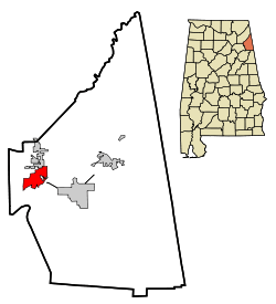 Location in Cherokee County and the state of Alabama | |
| Coordinates: 34°10′57″N 85°46′8″W / 34.18250°N 85.76889°W | |
| Country | United States |
| State | Alabama |
| County | Cherokee |
| Area | |
| • Total | 6.44 sq mi (16.67 km2) |
| • Land | 6.42 sq mi (16.62 km2) |
| • Water | 0.02 sq mi (0.05 km2) |
| Elevation | 610 ft (186 m) |
| Population (2010) | |
| • Total | 1,027 |
| • Density | 160/sq mi (61.8/km2) |
| Time zone | Central (CST) (UTC-6) |
| • Summer (DST) | CDT (UTC-5) |
| ZIP code | 35983 |
| Area code(s) | 256 |
| FIPS code | 01-42016 |
| GNIS feature ID | 0152019 |
| Website |
www |
Leesburg is a town in Cherokee County, Alabama, United States. At the 2010 census, the population was 1,027.[1]
History
Leesburg was originally called Hamptonville; it was named for Joseph Hampton and the Henslee family respectively.[2] A post office was established as Hamptonville in 1836, and in 1839 the name was changed to Leesburg.[3]
Geography
Leesburg is located in western Cherokee County at 34°10'57.446" North, 85°46'8.350" West (34.182624, -85.768986).[4] It is bordered by Lookout Mountain and the town of Sand Rock to the north and Weiss Lake on the Coosa River to the south. Weiss Dam, forming the lake, is located just south of the town limits.
According to the U.S. Census Bureau, Leesburg has a total area of 6.4 square miles (16.7 km2), of which 0.019 square miles (0.05 km2), or 0.29%, is water.[1]
Demographics
| Historical population | |||
|---|---|---|---|
| Census | Pop. | %± | |
| 1970 | 98 | — | |
| 1980 | 116 | 18.4% | |
| 1990 | 218 | 87.9% | |
| 2000 | 799 | 266.5% | |
| 2010 | 1,027 | 28.5% | |
| Est. 2015 | 1,014 | [5] | −1.3% |
| U.S. Decennial Census[6] 2013 Estimate[7] | |||
As of the census[8] of 2010, there were 1,027 people, 409 households, and 298 families residing in the town. The population density was 160 people per square mile (61.8/km²). There were 663 housing units at an average density of 103.6 per square mile (39.8/km²). The racial makeup of the town was 96.5% White, 0.0% Native American, 0.0% Asian, 0.5% from other races, and 1.9% from two or more races. 1.3% of the population were Hispanic or Latino of any race.
There were 409 households out of which 29.1% had children under the age of 18 living with them, 55.3% were married couples living together, 11.0% had a female householder with no husband present, and 27.1% were non-families. 22.0% of all households were made up of individuals and 9.3% had someone living alone who was 65 years of age or older. The average household size was 2.51 and the average family size was 2.90.
In the town the population was spread out with 23.5% under the age of 18, 8.9% from 18 to 24, 25.1% from 25 to 44, 29.4% from 45 to 64, and 13.1% who were 65 years of age or older. The median age was 40.4 years. For every 100 females there were 103.4 males. For every 100 females age 18 and over, there were 102.8 males.
The median income for a household in the town was $36,806, and the median income for a family was $45,714. Males had a median income of $32,075 versus $26,793 for females. The per capita income for the town was $18,392. About 12.5% of families and 15.6% of the population were below the poverty line, including 18.2% of those under age 18 and 12.2% of those age 65 or over.
Climate
Climate is characterized by relatively high temperatures and evenly distributed precipitation throughout the year. The Köppen Climate Classification subtype for this climate is "Cfa" (Humid Subtropical Climate).[9]
Notable person
References
- 1 2 "Geographic Identifiers: 2010 Demographic Profile Data (G001): Leesburg town, Alabama". U.S. Census Bureau, American Factfinder. Retrieved June 3, 2014.
- ↑ "Cherokee County, Ala.". Calhoun Times. September 1, 2004. p. 45. Retrieved 24 April 2015.
- ↑ "Cherokee County". Jim Forte Postal History. Retrieved 25 April 2015.
- ↑ "US Gazetteer files: 2010, 2000, and 1990". United States Census Bureau. 2011-02-12. Retrieved 2011-04-23.
- ↑ "Annual Estimates of the Resident Population for Incorporated Places: April 1, 2010 to July 1, 2015". Retrieved July 2, 2016.
- ↑ "U.S. Decennial Census". Census.gov. Retrieved June 6, 2013.
- ↑ "Annual Estimates of the Resident Population: April 1, 2010 to July 1, 2013". Retrieved June 3, 2014.
- ↑ "American FactFinder". United States Census Bureau. Retrieved 2015-07-11.
- ↑ Climate Summary for Leesburg, Alabama
External links
Coordinates: 34°10′57″N 85°46′08″W / 34.182624°N 85.768986°W
Municipalities and communities of Cherokee County, Alabama, United States | ||
|---|---|---|
| City | 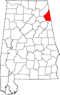 | |
| Towns | ||
| CDPs | ||
| Unincorporated communities | ||
| Ghost town | ||
| Footnotes | ‡This populated place also has portions in an adjacent county or counties | |