Lemannville, Louisiana
| Lemannville, Louisiana | |
|---|---|
| Census-designated place | |
 Lemannville Location within the state of Louisiana | |
| Coordinates: 30°6′33″N 90°55′13″W / 30.10917°N 90.92028°WCoordinates: 30°6′33″N 90°55′13″W / 30.10917°N 90.92028°W | |
| Country | United States |
| State | Louisiana |
| Parishes | Ascension, St. James |
| Area | |
| • Total | 1.3 sq mi (3.3 km2) |
| • Land | 1.0 sq mi (2.6 km2) |
| • Water | 0.3 sq mi (0.7 km2) |
| Elevation | 21 ft (6 m) |
| Population (2010) | |
| • Total | 860 |
| • Density | 852/sq mi (328.9/km2) |
| Time zone | Central (CST) (UTC-6) |
| • Summer (DST) | CST (UTC-5) |
| FIPS code | 22-43255 |
Lemannville is an unincorporated community and census-designated place in Ascension and St. James parishes, Louisiana, United States. As of the 2010 census, it had a population of 860.[1]
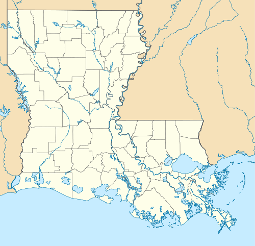
Lemannville is located on the west bank of the Mississippi River along Louisiana Highway 18, 6 miles (10 km) east of Donaldsonville and 60 miles (100 km) west of New Orleans.
References
- ↑ "Geographic Identifiers: 2010 Demographic Profile Data (G001): Lemannville CDP, Louisiana". U.S. Census Bureau, American Factfinder. Retrieved May 14, 2013.
Municipalities and communities of Ascension Parish, Louisiana, United States | ||
|---|---|---|
| Cities | 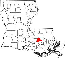 | |
| Town | ||
| CDPs | ||
| Other unincorporated communities |
| |
| Footnotes | ‡This populated place also has portions in an adjacent parish or parishes | |
Municipalities and communities of St. James Parish, Louisiana, United States | ||
|---|---|---|
| Towns |  | |
| CDPs |
| |
| Unincorporated community | ||
| Footnotes | ‡This populated place also has portions in an adjacent parish or parishes | |
This article is issued from Wikipedia - version of the 12/13/2013. The text is available under the Creative Commons Attribution/Share Alike but additional terms may apply for the media files.