Lemonville, Ontario
| Lemonville | |
|---|---|
| Unincorporated community | |
| Coordinates: 43°59′19″N 79°18′32″W / 43.98861°N 79.30889°WCoordinates: 43°59′19″N 79°18′32″W / 43.98861°N 79.30889°W | |
| Country | Canada |
| Province | Ontario |
| Regional municipality | York Region |
| Town | Whitchurch–Stouffville |
| Amalgamation |
(With Town of Stouffville) 1 January 1971 |
| Government | |
| • Type | Municipality |
| • Mayor | Justin Altmann |
| • Councillor, Ward 3 | Hugo Kroon |
| Elevation | 290 m (950 ft) |
| Time zone | EST (UTC−5) |
| • Summer (DST) | EDT (UTC−4) |
| Forward sortation area | L4A |
| Area code(s) | 905 and 289 |
Lemonville is a hamlet in York Region, Ontario, Canada, in the town of Whitchurch–Stouffville. The hamlet is centred at the intersection of McCowan Road and Bloomington Road, in the geographical centre of Whitchurch-Stouffville.[1]
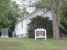
Lemonville United Church
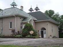
Lemonville Community Centre, Lemonville, Ontario
The town was named after George Lemon, who was granted land at this location in 1805. In 1877 the town reached a population of 100.[2]
References
| Wikimedia Commons has media related to Lemonville, Ontario. |
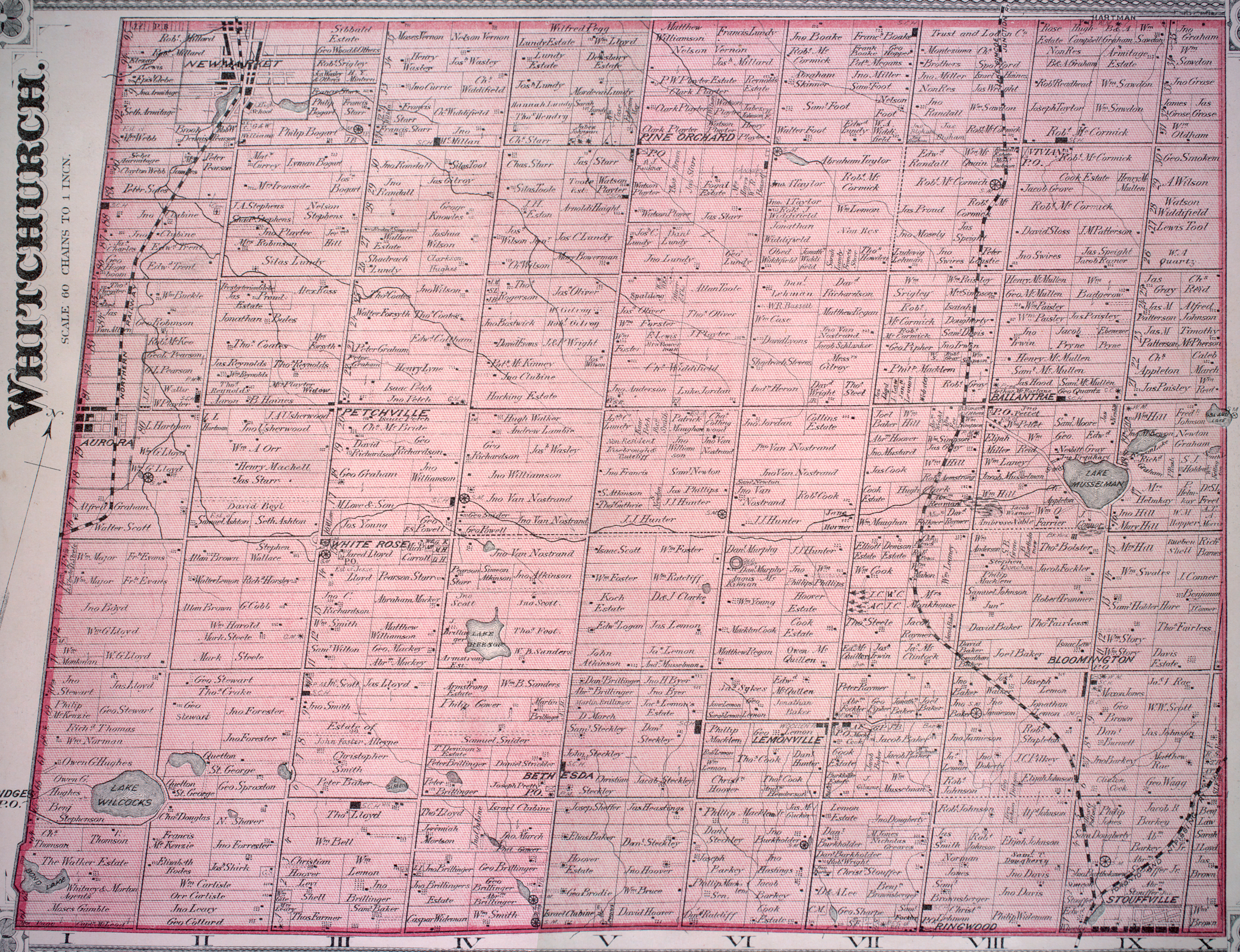
- ↑ See the detailed 1878 map: Township of Whitchurch, Illustrated historical atlas of the county of York and the township of West Gwillimbury & town of Bradford in the county of Simcoe, Ont. (Toronto: Miles & Co., 1878).
- ↑ For a brief account of Lemonville's history, cf. Jean Barkey et al., Whitchurch Township (Erin, ON: Boston Mills, 1993), 79-81.
This article is issued from Wikipedia - version of the 10/22/2015. The text is available under the Creative Commons Attribution/Share Alike but additional terms may apply for the media files.