Lenningen, Luxembourg
| Lenningen Lenneng | ||
|---|---|---|
| Commune | ||
 | ||
| ||
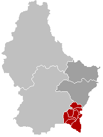
 Map of Luxembourg with Lenningen highlighted in orange, and the canton in dark red | ||
| Coordinates: 49°36′00″N 6°22′00″E / 49.6°N 6.3667°ECoordinates: 49°36′00″N 6°22′00″E / 49.6°N 6.3667°E | ||
| Country |
| |
| Canton | Remich | |
| Government | ||
| • Mayor | Arnold Rippinger | |
| Area | ||
| • Total | 20.35 km2 (7.86 sq mi) | |
| Area rank | 56 of 105 | |
| Highest elevation | 321 m (1,053 ft) | |
| • Rank | 97th of 105 | |
| Lowest elevation | 166 m (545 ft) | |
| • Rank | 12th of 105 | |
| Population (2014) | ||
| • Total | 1,768 | |
| • Rank | 77th of 105 | |
| • Density | 87/km2 (230/sq mi) | |
| • Density rank | 65th of 105 | |
| Time zone | CET (UTC+1) | |
| • Summer (DST) | CEST (UTC+2) | |
| LAU 2 | LU00008004 | |
| Website | lenningen.lu | |

Lenningen (Luxembourgish: Lenneng) is a commune and small town in southeastern Luxembourg. The commune has a population of about 1,900. It is located about 20 km east of the capital city, Luxembourg City. The commune's administrative centre is Canach.
As of 2013, the town of Lenningen, which lies in the east of the commune, has a population of 385.[1] The only other town within the commune is Canach.
References
- ↑ La commune en chiffres - Lenningen Commune (French)
External links
-
 Media related to Lenningen, Luxembourg at Wikimedia Commons
 |
Flaxweiler | | ||
| Schuttrange (L) Contern (L) |
|
Wormeldange | ||
| ||||
| | ||||
| Waldbredimus | Bous, Stadtbredimus |
 | ||
This article is issued from Wikipedia - version of the 12/1/2016. The text is available under the Creative Commons Attribution/Share Alike but additional terms may apply for the media files.