Les Hauteurs, Quebec
| Les Hauteurs | |
|---|---|
| Municipality | |
.jpg) | |
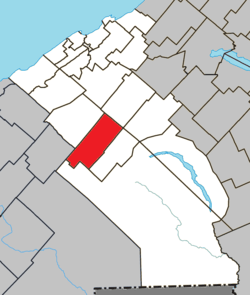 Location within La Mitis RCM | |
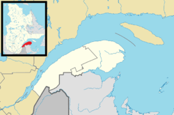 Les Hauteurs Location in eastern Quebec | |
| Coordinates: 48°23′N 68°07′W / 48.383°N 68.117°WCoordinates: 48°23′N 68°07′W / 48.383°N 68.117°W[1] | |
| Country |
|
| Province |
|
| Region | Bas-Saint-Laurent |
| RCM | La Mitis |
| Constituted | November 7, 1918 |
| Government[2] | |
| • Mayor | Noël Lambert |
| • Federal riding | Haute-Gaspésie—La Mitis—Matane—Matapédia |
| • Prov. riding | Matane-Matapédia |
| Area[2][3] | |
| • Total | 104.40 km2 (40.31 sq mi) |
| • Land | 102.28 km2 (39.49 sq mi) |
| Population (2011)[3] | |
| • Total | 524 |
| • Density | 5.1/km2 (13/sq mi) |
| • Pop 2006-2011 |
|
| • Dwellings | 249 |
| Time zone | EST (UTC−5) |
| • Summer (DST) | EDT (UTC−4) |
| Postal code(s) | G0K 1C0 |
| Area code(s) | 418 and 581 |
| Highways |
|
| Website |
municipalite leshauteurs |
Les Hauteurs is a municipality in Quebec, Canada.
See also
References
External links
-
 Media related to Les Hauteurs, Quebec at Wikimedia Commons
 |
Saint-Gabriel-de-Rimouski | |
Sainte-Jeanne-d'Arc | |
| Saint-Marcellin | |
La Rédemption | ||
| ||||
| | ||||
| Lac-des-Eaux-Mortes | Saint-Charles-Garnier |
| Cities & Towns | |
|---|---|
| Municipalities | |
| Parishes | |
| Villages | |
| Unorganized territories | |
| |
This article is issued from Wikipedia - version of the 12/1/2016. The text is available under the Creative Commons Attribution/Share Alike but additional terms may apply for the media files.