Liebenthal, Kansas
| Liebenthal, Kansas | |
|---|---|
| City | |
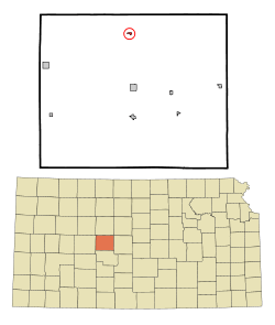 Location within Rush County and Kansas | |
 KDOT map of Rush County (legend) | |
| Coordinates: 38°39′18″N 99°19′14″W / 38.65500°N 99.32056°WCoordinates: 38°39′18″N 99°19′14″W / 38.65500°N 99.32056°W | |
| Country | United States |
| State | Kansas |
| County | Rush |
| Area[1] | |
| • Total | 0.13 sq mi (0.34 km2) |
| • Land | 0.13 sq mi (0.34 km2) |
| • Water | 0 sq mi (0 km2) |
| Elevation | 1,972 ft (601 m) |
| Population (2010)[2] | |
| • Total | 103 |
| • Estimate (2015)[3] | 98 |
| • Density | 790/sq mi (300/km2) |
| Time zone | Central (CST) (UTC-6) |
| • Summer (DST) | CDT (UTC-5) |
| ZIP code | 67553 |
| Area code(s) | 785 |
| FIPS code | 20-40400 [4] |
| GNIS feature ID | 0475388 [5] |
Liebenthal is a city in Rush County, Kansas, United States. As of the 2010 census, the city population was 103.[6]
History
Liebenthal was founded in 1876 by a colony of Volga Germans,[7][8][9] many of whom came from (Groß)Liebenthal, Russia.[9]
Geography
Liebenthal is located at 38°39′18″N 99°19′14″W / 38.65500°N 99.32056°W (38.654948, -99.320625).[10] According to the United States Census Bureau, the city has a total area of 0.13 square miles (0.34 km2), all of it land.[1]
Climate
The climate in this area is characterized by hot, humid summers and generally mild to cool winters. According to the Köppen Climate Classification system, Liebenthal has a humid subtropical climate, abbreviated "Cfa" on climate maps.[11]
Demographics
| Historical population | |||
|---|---|---|---|
| Census | Pop. | %± | |
| 1940 | 265 | — | |
| 1950 | 211 | −20.4% | |
| 1960 | 191 | −9.5% | |
| 1970 | 169 | −11.5% | |
| 1980 | 163 | −3.6% | |
| 1990 | 112 | −31.3% | |
| 2000 | 111 | −0.9% | |
| 2010 | 103 | −7.2% | |
| Est. 2015 | 98 | [3] | −4.9% |
| U.S. Decennial Census | |||
2010 census
As of the census[2] of 2010, there were 103 people, 47 households, and 31 families residing in the city. The population density was 792.3 inhabitants per square mile (305.9/km2). There were 60 housing units at an average density of 461.5 per square mile (178.2/km2). The racial makeup of the city was 98.1% White and 1.9% from two or more races.
There were 47 households of which 19.1% had children under the age of 18 living with them, 51.1% were married couples living together, 10.6% had a female householder with no husband present, 4.3% had a male householder with no wife present, and 34.0% were non-families. 31.9% of all households were made up of individuals and 12.8% had someone living alone who was 65 years of age or older. The average household size was 2.19 and the average family size was 2.74.
The median age in the city was 47.1 years. 15.5% of residents were under the age of 18; 4.8% were between the ages of 18 and 24; 23.3% were from 25 to 44; 38.9% were from 45 to 64; and 17.5% were 65 years of age or older. The gender makeup of the city was 51.5% male and 48.5% female.
2000 census
As of the census[4] of 2000, there were 111 people, 48 households, and 32 families residing in the city. The population density was 898.3 people per square mile (357.1/km²). There were 56 housing units at an average density of 453.2 per square mile (180.2/km²). The racial makeup of the city was 98.20% White, 0.90% Native American, and 0.90% from two or more races.
There were 48 households out of which 22.9% had children under the age of 18 living with them, 52.1% were married couples living together, 4.2% had a female householder with no husband present, and 33.3% were non-families. 29.2% of all households were made up of individuals and 16.7% had someone living alone who was 65 years of age or older. The average household size was 2.31 and the average family size was 2.81.
In the city the population was spread out with 19.8% under the age of 18, 3.6% from 18 to 24, 31.5% from 25 to 44, 27.0% from 45 to 64, and 18.0% who were 65 years of age or older. The median age was 42 years. For every 100 females there were 122.0 males. For every 100 females age 18 and over, there were 111.9 males.
The median income for a household in the city was $21,875, and the median income for a family was $29,792. Males had a median income of $26,250 versus $14,375 for females. The per capita income for the city was $14,342. There were no families and 11.1% of the population living below the poverty line, including no under eighteens and 20.0% of those over 64.
Further reading
References
- 1 2 "US Gazetteer files 2010". United States Census Bureau. Archived from the original on January 24, 2012. Retrieved 2012-07-06.
- 1 2 "American FactFinder". United States Census Bureau. Retrieved 2012-07-06.
- 1 2 "Annual Estimates of the Resident Population for Incorporated Places: April 1, 2010 to July 1, 2015". Retrieved July 2, 2016.
- 1 2 "American FactFinder". United States Census Bureau. Archived from the original on September 11, 2013. Retrieved 2008-01-31.
- ↑ "US Board on Geographic Names". United States Geological Survey. 2007-10-25. Retrieved 2008-01-31.
- ↑ "2010 City Population and Housing Occupancy Status". U.S. Census Bureau. Archived from the original on July 21, 2011. Retrieved September 16, 2011.
- ↑ "Liebenthal, Kansas". Legends of Kansas. Retrieved 22 June 2014.
- ↑ "Liebenthal, KS". Rush County, Kansas. Retrieved 22 June 2014.
- 1 2 "The Merchants of Hays Salute the Community of Liebenthal". The Hays Daily News. September 27, 1963. p. 6. Retrieved December 23, 2014 – via Newspapers.com.

- ↑ "US Gazetteer files: 2010, 2000, and 1990". United States Census Bureau. 2011-02-12. Retrieved 2011-04-23.
- ↑ Climate Summary for Liebenthal, Kansas
External links
| Wikimedia Commons has media related to Liebenthal, Kansas. |
- City
- Schools
- USD 395, local school district
- Photos
- Historical
- History of Cities in Rush County
- Liebenthal Info, Legends of Kansas
- Maps
- Liebenthal City Map, KDOT
Municipalities and communities of Rush County, Kansas, United States | ||
|---|---|---|
| Cities | 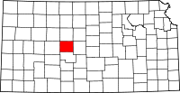 | |
| Unincorporated communities | ||