Lins, São Paulo
| Lins | |
|---|---|
| Municipality | |
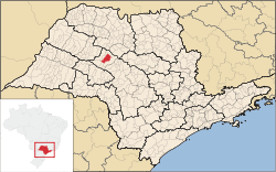 Location in São Paulo state | |
 Lins Location in Brazil | |
| Coordinates: 21°40′43″S 49°44′33″W / 21.67861°S 49.74250°WCoordinates: 21°40′43″S 49°44′33″W / 21.67861°S 49.74250°W | |
| Country |
|
| Region | Southeast Region |
| State | São Paulo |
| Area | |
| • Total | 570 km2 (220 sq mi) |
| Population (2015) | |
| • Total | 76,092 |
| • Density | 130/km2 (350/sq mi) |
| Time zone | BRT/BRST (UTC-3/-2) |
Lins is a municipality in the western part of the state of São Paulo in Brazil. The population is 76,092 (2015 est.) in an area of 570 km².[1] The elevation is 437 m. Distance is 455 km from the capital, São Paulo.
History
The town was founded in the beginning of the 20th century, at first with the name of Santo Antônio do Campestre, and grew after the arrival of the Estrada de Ferro Noroeste do Brasil (The Northwest railroad of Brazil). It became an independent municipality in 1920, when it was separated from the municipality Pirajuí. It was named after Manoel Joaquim de Albuquerque Lins, who was the president of the state of São Paulo from 1908 to 1912. The name was officially changed from Albuquerque Lins to Lins in 1926.[2]
The city is served by Gov. Lucas Nogueira Garcez Airport.
Demography
2000 census
total population: 65.952
- urban: 64.218
- Rural: 1.734
- men: 31.990
- women: 33.962
- population density (hab./km²): 115,42
- child mortality (per thousands): 11,79
- life expectance (years): 73,56
- birth rate (per woman): 1,97
- literacy rate: 92,48%
human development index (HDI-M): 0,724
- HDI-M Renda: 0,782
- HDI-M Longevidade: 0,809
- HDI-M Education: 0,791
(source: IPEADATA)
References
 |
Sabino | | ||
| Guaiçara | |
Cafelândia | ||
| ||||
| | ||||
| Getulina and Guaimbê |