List of Indiana state historical markers in Ripley County
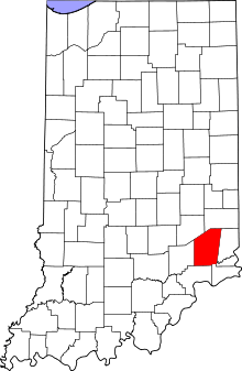
Location of Ripley County in Indiana
This is a list of the Indiana state historical markers in Ripley County.
This is intended to be a complete list of the official state historical markers placed in Ripley County, Indiana, United States by the Indiana Historical Bureau. The locations of the historical markers and their latitude and longitude coordinates are included below when available, along with their names, years of placement, and topics as recorded by the Historical Bureau. There are 7 historical markers located in Ripley County.[1]
Historical markers
| Marker title | Image | Year placed | Location | Topics |
|---|---|---|---|---|
| Michigan Road[2] | 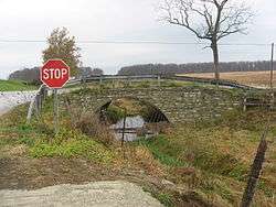 |
1949 | Junction of U.S. Route 50 and N. Old Michigan Road, 2 miles east of Holton 39°4′30″N 85°20′55″W / 39.07500°N 85.34861°W |
Transportation, American Indian/Native American |
| Morgan's Raid July 8-13, 1863[3] | 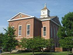 |
1963 | Eastern entrance to the Ripley County Courthouse in Versailles 39°4′19″N 85°15′5″W / 39.07194°N 85.25139°W |
Military |
| Berry's Trace[4] |  |
1972 | Junction of Madison (U.S. Route 421) and Wilson Streets in Napoleon 39°12′22″N 85°19′49.4″W / 39.20611°N 85.330389°W |
Transportation, Early Settlement and Exploration |
| Union Church[5] | 2004 | 6303 County Road 975W at the Flat Rock Road/County Road 650N junction near Flat Rock 39°9′53″N 85°26′26″W / 39.16472°N 85.44056°W |
Underground Railroad, African American | |
| Stephen S. Harding[6] | 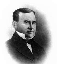 |
2004 | Junction of Washington and Tyson Streets on the southwestern corner of the courthouse square in Versailles 39°4′18.4″N 85°15′7.6″W / 39.071778°N 85.252111°W |
Underground Railroad, Politics, African American |
| Ohio and Mississippi Railroad[7] | 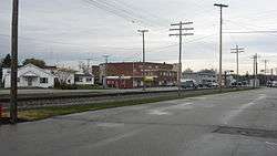 |
2006 | Southern side of the CSX railroad line, near Walnut Street across from the new extension of the library in Osgood 39°7′48″N 85°17′31″W / 39.13000°N 85.29194°W |
Transportation, Business, Industry, and Labor, Buildings and Architecture |
| James Harrison Cravens[8] | 2006 | By Cravens' 1865 home at 324 E. Fairground Avenue in Osgood 39°7′57″N 85°17′10″W / 39.13250°N 85.28611°W |
Politics, Underground Railroad, Military |
See also
- List of Indiana state historical markers
- National Register of Historic Places listings in Ripley County, Indiana
References
- ↑ "Indiana Historical Markers by County". State of Indiana. Retrieved 2012-03-15.
- ↑ Michigan Road, Indiana Historical Bureau, n.d. Accessed 2012-03-14.
- ↑ Morgan's Raid July 8-13, 1863, Indiana Historical Bureau, n.d. Accessed 2012-03-14.
- ↑ Berry's Trace, Indiana Historical Bureau, n.d. Accessed 2012-03-14.
- ↑ Union Church, Indiana Historical Bureau, n.d. Accessed 2012-03-14.
- ↑ Stephen S. Harding, Indiana Historical Bureau, n.d. Accessed 2012-03-14.
- ↑ Ohio and Mississippi Railroad, Indiana Historical Bureau, n.d. Accessed 2012-03-14.
- ↑ James Harrison Cravens, Indiana Historical Bureau, n.d. Accessed 2012-03-14.
External links
Municipalities and communities of Ripley County, Indiana, United States | ||
|---|---|---|
| City | ||
| Towns | ||
| Townships | ||
| Unincorporated communities |
| |
| Footnotes | ‡This populated place also has portions in an adjacent county or counties | |
This article is issued from Wikipedia - version of the 8/9/2016. The text is available under the Creative Commons Attribution/Share Alike but additional terms may apply for the media files.