List of localities in Waikato
| Waikato Region | |
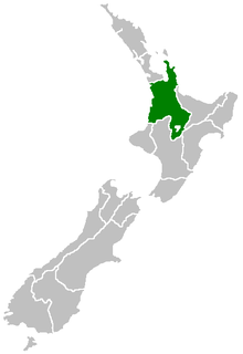 | |
This is a list of localities in Waikato as defined by government agency Statistics New Zealand, listed by the territorial authorities to which each locality belongs. Waikato is a region of New Zealand in the central North Island which reaches from coast to coast and from Coromandel Peninsula in the north to Lake Taupo and King Country in the south.[1] It is bordered by Auckland to the north, Bay of Plenty to the east, and Taranaki, Manawatu-Wanganui and Hawke's Bay to the south.
Thames-Coromandel District
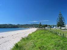
The Thames-Coromandel District is located in the area around the Firth of Thames and Coromandel Peninsula, to the southeast of Auckland. At the 2006 Census, Thames-Coromandel had 25,941 people (including 4,020 self-identified Maori) and 22,704 occupied dwellings. The district council is seated in the district's largest town, Thames, and was constituted before any other district council in 1975. Thames is located in the southwest of the district; the other major settlements are Whitianga in the northeast and Whangamata in the southeast.
| Locality | Population | Occupied Dwellings | |
|---|---|---|---|
| Whitianga | 3,768 (2006)[2] | 1,674 (2006)[3] | |
| Coromandel | 1,473 (2006)[4] | 642 (2006)[5] | |
| Te Rerenga | 4,173 (2006)[6] | 1,896 (2006)[7] | |
| Whangamata | 3,555 (2006)[8] | 1,701 (2006)[9] | |
| Tairua | 1,269 (2006)[10] | 603 (2006)[11] | |
| Moanataiari | 2,472 (2006)[12] | 1,146 (2006)[13] | |
| Parawai | 4,284 (2006)[14] | 1,734 (2006)[15] | |
| Pauanui Beach | 4,284 (2006)[16] | 1,734 (2006)[17] | |
| Hikuai | 3,252 (2006)[18] | 1,314 (2006)[19] | |
| Te Puru-Thornton Bay | 942 (2006)[20] | 426 (2006)[21] | |
| Inlets-Thames-Coromandel District | n/a | n/a | |
| Islands-Thames-Coromandel District | 12 (2006)[22] | n/a | |
Hauraki District
| Locality | Population | Occupied Dwellings | Features and Facilities | |
|---|---|---|---|---|
| Ngatea | ||||
| Hauraki Plains | ||||
| Turua | ||||
| Kerepehi | ||||
| Ohinemuri | ||||
| Paeroa | ||||
| Waihi | ||||
Waikato District
| Locality | Population | Occupied Dwellings | Features and Facilities | |
|---|---|---|---|---|
| Buckland | ||||
| Redoubt | ||||
| Opuawhanga | ||||
| Pokeno | ||||
| Mangatawhiri | ||||
| Otaua | ||||
| South Waiuku | ||||
| Tuakau | ||||
| Onewhero | ||||
| Rotowaro | ||||
| Raglan | ||||
| Waikato Western Hills | Waikato Western Hills is a census area unit covering a large low population area within Waikato District. It includes the localities of Rotongaro, Ruawaro, Renown, Mahuta, Glen Afton, Glen Massey, Waingaro, Ohautira, Waitetuna, Glen Tui and Karakariki.[23] | |||
| Te Uku | Area unit includes Te Mata, Ruapuke and the north side of Aotea Harbour. | |||
| Te Akau | ||||
| Te Kauwhata | ||||
| Matangi | ||||
| Whitikahu | ||||
| Taupiri | ||||
| Eureka | ||||
| Gordonton | ||||
| Kainui | ||||
| Tamahere-Tauwhare | ||||
| Waerenga | ||||
| Maramarua | ||||
| Meremere | ||||
| Huntly West | ||||
| Huntly East | ||||
| Horotiu | ||||
| Te Kowhai | ||||
| Whatawhata | ||||
| Ngaruawahia | ||||
| Inlet-Raglan Harbour | ||||
| Inlet-Aotea Harbour North | ||||
Matamata-Piako District
| Locality | Population | Occupied Dwellings | Features and Facilities | |
|---|---|---|---|---|
| Tahuroa | ||||
| Waitoa | ||||
| Springdale | ||||
| Waihou-Walton | ||||
| Te Aroha | ||||
| Morrinsville West | ||||
| Morrinsville East | ||||
| Waharoa | ||||
| Okauia | ||||
| Te Poi | ||||
| Hinuera | ||||
| Matamata North | ||||
| Matamata South | ||||
| Mangateparu |
Hamilton City
| Locality | Population | Occupied Dwellings | Features and Facilities | |
|---|---|---|---|---|
| Sylvester | ||||
| Flagstaff | ||||
| Horsham Downs | ||||
| Rototuna | ||||
| Huntington | ||||
| Peacocke | ||||
| Temple View | ||||
| Bryant | ||||
| Pukete | ||||
| Pukete West | ||||
| Te Rapa | ||||
| Burbush | ||||
| Rotokauri | ||||
| Nawton | ||||
| Crawshaw | ||||
| Grandview | ||||
| Brymer | ||||
| Dinsdale North | ||||
| Dinsdale South | ||||
| Beerescourt | ||||
| Maeroa | ||||
| Frankton Junction | ||||
| Swarbrick | ||||
| Hamilton Lake | ||||
| Melville | ||||
| Glenview | ||||
| Queenwood | ||||
| Chedworth | ||||
| Porritt | ||||
| Insoll | ||||
| Fairview Downs | ||||
| Chartwell | ||||
| Hamilton Central | ||||
| Clarkin | ||||
| Claudelands | ||||
| Enderley | ||||
| Peachgrove | ||||
| Hamilton East | ||||
| Naylor | ||||
| Bader | ||||
| University | ||||
| Silverdale | ||||
| Hillcrest West | ||||
| Riverlea | ||||
Waipa District

| Locality | Population | Occupied Dwellings | Features and Facilities | |
|---|---|---|---|---|
| Te Pahu | ||||
| Hautapu | ||||
| Cambridge - North | ||||
| Cambridge - West | ||||
| Cambridge - Central | ||||
| Cambridge - Leamington West | ||||
| Cambridge - Leamington East | ||||
| Ohaupo | ||||
| Kihikihi | ||||
| Ngahinapouri | ||||
| Lake Cameron | ||||
| Te Rore | ||||
| Pirongia | ||||
| Pokuru | ||||
| Lake Ngaroto | ||||
| Tokanui | ||||
| Pukerimu | ||||
| Kaipaki | ||||
| Rotoorangi | ||||
| Te Rahu | ||||
| Kihikihi Flat | ||||
| Allen Road | ||||
| Rotongata | ||||
| Te Awamutu West | ||||
| Te Awamutu Central | ||||
| Te Awamutu East | ||||
| Te Awamutu South | ||||
| Karapiro | ||||
Otorohanga District
| Locality | Population | Occupied Dwellings | Features and Facilities | |
|---|---|---|---|---|
| Kawhia - Community | ||||
| Otorohanga - Town | ||||
| Otorohanga - Rural West | ||||
| Te Kawa | ||||
| Otorohanga - Rural East | ||||
| Te Motu Island | ||||
| Otorohanga District - Inlets | ||||
South Waikato District
| Locality | Population | Occupied Dwellings | Features and Facilities | |
|---|---|---|---|---|
| Tirau | ||||
| Mangakaretu | ||||
| Kinleith | ||||
| Tapapa | ||||
| Arapuni | ||||
| Lichfield | ||||
| Wawa | ||||
| Paraonui | ||||
| Parkdale | ||||
| Matarawa | ||||
| Stanley Park | ||||
| Tokoroa Central | ||||
| Aotea | ||||
| Strathmore | ||||
| Amisfield | ||||
Waitomo District
| Locality | Population | Occupied Dwellings | Features and Facilities | |
|---|---|---|---|---|
| Piopio | ||||
| Taharoa | ||||
| Mahoenui | ||||
| Marokopa | ||||
| Waipa Valley | ||||
| Mokauiti | ||||
| Te Kuiti | ||||
| Inlet-Waitomo District | ||||
| Putaruru | ||||
Taupo District
| Locality | Population | Occupied Dwellings | Features and Facilities | |
|---|---|---|---|---|
| Omori | ||||
| Kuratau | ||||
| Mangakino | ||||
| Turangi | ||||
| Acacia Bay | ||||
| Wairakei-Aratiatia | ||||
| Maunganamu | ||||
| Taupo East | ||||
| Wharewaka | ||||
| Rangatira Park | ||||
| Rangatira | ||||
| Lakewood | ||||
| Marotiri | ||||
| Oruanui | ||||
| Kinloch | ||||
| Iwitahi | ||||
| Rangipo | ||||
| Nukuhau | ||||
| Taupo Central | ||||
| Tauhara | ||||
| Hilltop | ||||
| Waipahihi | ||||
| Richmond Heights | ||||
| Inland Water - Lake Taupo | ||||
Rotorua District
| Locality | Population | Occupied Dwellings | Features and Facilities | |
|---|---|---|---|---|
| Golden Springs | ||||
| Reporoa | ||||
| Ngakuru | ||||
| Arahiwi | ||||
Area outside territorial authority
| Locality | Population | Occupied Dwellings | Features and Facilities | |
|---|---|---|---|---|
| Inlet - Firth of Thames | ||||
| Oceanic-Waikato Region West | ||||
| Bays-Thames-Coromandel District | ||||
| Oceanic-Waikato Region East | ||||
References
- ↑ "About the Waikato region". Environment Waikato. Retrieved 2009-07-06.
- ↑ "Census 2006". Statistics NZ. 2006-01-01. Retrieved 2010-01-08.
- ↑ "Census 2006". Statistics NZ. 2006-01-01. Retrieved 2010-01-08.
- ↑ "Census 2006". Statistics NZ. 2006-01-01. Retrieved 2010-01-08.
- ↑ "Census 2006". Statistics NZ. 2006-01-01. Retrieved 2010-01-08.
- ↑ "Census 2006". Statistics NZ. 2006-01-01. Retrieved 2010-01-08.
- ↑ "Census 2006". Statistics NZ. 2006-01-01. Retrieved 2010-01-08.
- ↑ "Census 2006". Statistics NZ. 2006-01-01. Retrieved 2010-01-08.
- ↑ "Census 2006". Statistics NZ. 2006-01-01. Retrieved 2010-01-08.
- ↑ "Census 2006". Statistics NZ. 2006-01-01. Retrieved 2010-01-08.
- ↑ "Census 2006". Statistics NZ. 2006-01-01. Retrieved 2010-01-08.
- ↑ "Census 2006". Statistics NZ. 2006-01-01. Retrieved 2010-01-08.
- ↑ "Census 2006". Statistics NZ. 2006-01-01. Retrieved 2010-01-08.
- ↑ "Census 2006". Statistics NZ. 2006-01-01. Retrieved 2010-01-08.
- ↑ "Census 2006". Statistics NZ. 2006-01-01. Retrieved 2010-01-08.
- ↑ "Census 2006". Statistics NZ. 2006-01-01. Retrieved 2010-01-08.
- ↑ "Census 2006". Statistics NZ. 2006-01-01. Retrieved 2010-01-08.
- ↑ "Census 2006". Statistics NZ. 2006-01-01. Retrieved 2010-01-08.
- ↑ "Census 2006". Statistics NZ. 2006-01-01. Retrieved 2010-01-08.
- ↑ "Census 2006". Statistics NZ. 2006-01-01. Retrieved 2010-01-08.
- ↑ "Census 2006". Statistics NZ. 2006-01-01. Retrieved 2010-01-08.
- ↑ "Census 2006". Statistics NZ. 2006-01-01. Retrieved 2010-01-08.
- ↑ NZStats interactive map