Ložnica, Velenje
| Ložnica | |
|---|---|
.jpg) | |
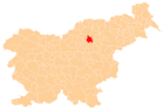
 Ložnica Location in Slovenia | |
| Coordinates: 46°20′15.14″N 15°5′48.88″E / 46.3375389°N 15.0969111°ECoordinates: 46°20′15.14″N 15°5′48.88″E / 46.3375389°N 15.0969111°E | |
| Country |
|
| Traditional region | Styria |
| Statistical region | Savinja |
| Municipality | Velenje |
| Area | |
| • Total | 1.7 km2 (0.7 sq mi) |
| Elevation | 338.4 m (1,110.2 ft) |
| Population (2002) | |
| • Total | 164 |
| [1] | |
Ložnica (pronounced [lɔˈʒniːtsa]) is a settlement in the Municipality of Velenje in northern Slovenia. It lies in the Ložnica Hills (Slovene: Ložničko gričevje) south of Velenje. The area was traditionally part of Styria. The entire municipality is now included in the Savinja Statistical Region.[2]
References
External links
- Ložnica at Geopedia
 Media related to Ložnica, Velenje at Wikimedia Commons
| Settlements | Administrative Centre: Velenje
|  | ||||||
|---|---|---|---|---|---|---|---|---|
| Landmarks |
| |||||||
| Notable people |
| |||||||
This article is issued from Wikipedia - version of the 11/10/2015. The text is available under the Creative Commons Attribution/Share Alike but additional terms may apply for the media files.