Long Gully, Victoria
| Long Gully Bendigo, Victoria | |
|---|---|
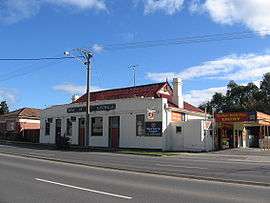 Rose of Australia Hotel | |
 Long Gully | |
| Coordinates | 36°44′S 144°15′E / 36.733°S 144.250°ECoordinates: 36°44′S 144°15′E / 36.733°S 144.250°E |
| Population | 3,338 (2011 census)[1] |
| Postcode(s) | 3550 |
| Location | 3 km (2 mi) NW of Bendigo |
| LGA(s) | City of Greater Bendigo |
| State electorate(s) | Bendigo West |
| Federal Division(s) | Bendigo |
Long Gully is a suburb of the regional city of Bendigo in Victoria, Australia 3 kilometres (1.9 mi) north-west of the Bendigo central business district. At the 2011 census, Long Gully had a population of 3,289.[1]
Long Gully is a working-class suburb of Bendigo, featuring many older style fibro houses, punctuated by well-established light industry. The suburb is the location of the Bendigo RSL club, in Havilah Road.
Long Gully was heavily affected by the Black Saturday bushfires, causing one death.[2]
References
| Wikimedia Commons has media related to Long Gully, Victoria. |
- 1 2 Australian Bureau of Statistics (31 October 2012). "Long Gully (State Suburb)". 2011 Census QuickStats. Retrieved 2015-06-23.
- ↑ "Victoria under siege as fires rage across state". Herald Sun. 8 February 2009. Archived from the original on February 8, 2009. Retrieved 2009-02-08.
This article is issued from Wikipedia - version of the 9/12/2016. The text is available under the Creative Commons Attribution/Share Alike but additional terms may apply for the media files.