Louisiana State Route 6
| |
|---|---|
| Route information | |
| Length: | 163.40 mi (262.97 km) |
| Existed: | 1921 – 1955 |
| Major junctions | |
| West end: |
|
|
| |
| East end: |
|
| Highway system | |
| |
.svg.png)
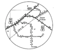
Louisiana State Route 6 (LA 6) was one of the 98 original state highways that were established in 1921. It ran in an east to west direction for 163.4 miles (263.0 km), spanning from Texas to Ferriday. The current LA 6 is about half of the original route; LA 6 also used US 84's corridor. For the most part, LA 6's number was spared during the 1955 Louisiana Highway renumbering, along with LA 15.
Route description
Beginning on Texas State Line at East Pendleton, thence through Many, Ft. Jessup, Robeline, Natchitoches, thence in a southerly direction to a point at or near Airey store, thence to intersect Irma Pace Road, thence to Old Racine Ferry, thence to Winnfield, Olla, Jena, Rhinehart, Archie, Jonesville, Ferriday to Vidalia. - 1924 Louisiana Legislative Route Description
From the west, LA 6 began at a bridge crossing the Sabine River, where TX 21 crossed into Louisiana. LA 6 then continued east to Many, crossing US 171. LA 6 then followed into Natchitoches, where it was paired with the Jefferson Highway for a short distance. LA 6 then crossed the Red River at Grand Ecore, meeting US 71 and beginning a concurrency with US 84.
After joining with US 84, LA 6 crossed into Winnfield, meeting US 167, forming a four-way concurrency with US 84/167 and LA 5/6. LA 6/US 84 continued east, with US 84 turning to the south while LA 6 continued east towards Olla. LA 6 crossed US 165 in Olla before turning to the south to meet US 84 and LA 19 in Jena. LA 6/19/US 84 ran concurrently to the community of Rinehart before LA 19 turned north towards Harrisonburg. LA 6/US 84 ran together through the town of Jonesville before ending at an intersection with US 65/LA 15 in Ferriday.
Scenes pertaining to LA 6
-
US 84 showing concurrency with LA 6 - Joyce, LA
-
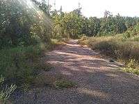
Abandoned section of US 84/LA 6 east of Jena, Louisiana
Major intersections
| Parish | Location | mi | km | Destinations | Notes |
|---|---|---|---|---|---|
| Sabine | Toledo Bend Reservoir | 0.0 | 0.0 | Western terminus | |
| Many | 17.6 | 28.3 | US 171 north to Mansfield | ||
| 18.0 | 29.0 | US 171 south to Hornbeck | |||
| Natchitoches | Robeline | 32.3 | 52.0 | ||
| | 38.7 | 62.3 | |||
| Natchitoches | 47.9 | 77.1 | |||
| | 52.5 | 84.5 | |||
| Clarence | 55.1 | 88.7 | |||
| 55.4 | 89.2 | Begin US 84 concurrency, end LA 1 concurrency | |||
| Winn | Winnfield | 79.5 | 127.9 | Begin US 167 concurrency | |
| 80.2 | 129.1 | ||||
| 81.4 | 131.0 | End US 167 concurrency | |||
| | 87.0 | 140.0 | End US 84 concurrency | ||
| La Salle | Olla | 106.7 | 171.7 | ||
| Jena | 122.9 | 197.8 | LA 57 south to Walker Ferry | ||
| Whitehall | 130.5 | 210.0 | LA 19 east to LA 18 | ||
| Catahoula | Jonesville | 146.9 | 236.4 | LA 18 north to LA 15 | |
| Concordia | | 148.9 | 239.6 | ||
| Ferriday | 163.6 | 263.3 | Eastern terminus | ||
| 1.000 mi = 1.609 km; 1.000 km = 0.621 mi | |||||