Loupin Stanes
| The Loupin Stanes | |
|---|---|
 | |
| Coordinates | 55°15′30″N 3°10′14″W / 55.258263°N 3.170489°WCoordinates: 55°15′30″N 3°10′14″W / 55.258263°N 3.170489°W |
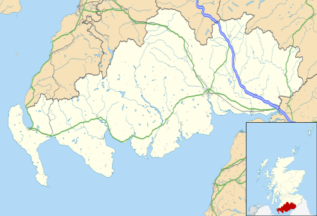 Location of The Loupin Stanes in Dumfries and Galloway | |
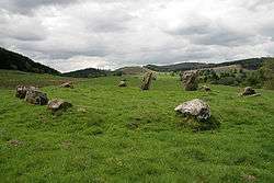
The Loupin Stanes (grid reference NY25709663) is a stone circle near Eskdalemuir, Dumfries and Galloway. Oval in shape, it consists of twelve stones set on an artificial platform.[1][2] At the WSW of the circle are two large pillars, which are typical of the 'entrance circles' of south-west Scotland.[3] The circle takes its name from the tradition of leaping between the tops of these two stones.[4][5][6]
There were two other circles nearby, which are now ruined and almost imperceptible.[1] A line of stones leads south to the Girdle Stanes; it is possible that these are the remains of an avenue linking the two circles.[2][1]
See also
References
- 1 2 3 Burl, Aubrey (2005). A Guide to the Stone Circles of Britain, Ireland and Brittany. New Haven; London: Yale University Press. p. 123.
- 1 2 Burl, Aubrey (2000). The Stone Circles of Britain, Ireland and Brittany. New Haven and London: Yale University Press. p. 255.
- ↑ Burl, Aubrey (2005). A Guide to the Stone Circles of Britain, Ireland and Brittany. New Haven; London: Yale University Press. p. 309.
- ↑ Christison, David (1897). "'The Girdlestanes,' and a Neighbouring Stone Circle, in the Parish of Eskdalemuir, Dumfriesshire" (PDF). Proceedings of the Society of Antiquaries of Scotland: 285.
- ↑ Hyslop, John; Hyslop, Robert (1912). Langholm as it was: A History of Langholm and Eskdale from the Earliest Time. Sunderland: Hills and Company. p. 19.
- ↑ Burl, Aubrey (2005). A Guide to the Stone Circles of Britain, Ireland and Brittany. New Haven; London: Yale University Press. p. 124.
This article is issued from Wikipedia - version of the 8/15/2015. The text is available under the Creative Commons Attribution/Share Alike but additional terms may apply for the media files.