Lower Queen Anne, Seattle
| Lower Queen Anne | |
|---|---|
| Neighbourhood | |
|
View of Lower Queen Anne from Queen Anne Ave. N and W Republican St. | |
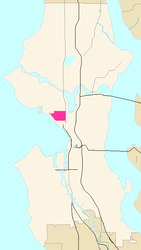 Map of Lower Queen Anne's location in Seattle | |
| City | Seattle |
| Area | |
| • Total | 0.62 sq mi (1.60 km2) |
| Population | |
| • Total | 10,765 |
| • Density | 7,969/sq mi (3,077/km2) |

Lower Queen Anne (also known as Uptown due to its large residential population) is a neighborhood in Seattle, Washington, at the base of Queen Anne Hill. While its boundaries are not precise, the toponym usually refers to the shopping, office, and residential districts to the north and west of Seattle Center. The neighborhood is connected to Upper Queen Anne—the shopping district at the top of the hill—by an extremely steep section of Queen Anne Avenue N. known as the Counterbalance, in memory of the cable cars that once ran up and down it.
While "Lower Queen Anne" and "Uptown" are rarely used to refer to the grounds of Seattle Center itself, many of Seattle Center's leading attractions abut the neighborhood; these include KeyArena (home of the Seattle Storm of the WNBA), the Exhibition Hall, McCaw Hall (home of the Seattle Opera and Pacific Northwest Ballet), the Intiman Playhouse (home of the Intiman theater company), and the Bagley Wright Theater (home of Seattle Repertory Theater), as well as the Mercer Arena.
Lower Queen Anne also has a three-screen movie theater, the Uptown, and On the Boards, a center for avant-garde theater and music.
Largely because of its proximity to Seattle Center, Lower Queen Anne is home to some 100 restaurants, bars, and fast-food locations, such as Pagliacci Pizza, Dick's Drive In, Nielsen's Danish Pastries, & The Mecca Cafe. Nestled on the side streets amongst the apartment and condo communities are an array of retail shops such as Peridot, Juniper Flowers and Choice Linens.

Geography
Lower Queen Anne can be considered either a distinct neighborhood, or part of the larger Queen Anne. Although the borders of Lower Queen Anne are not clearly defined, they usually include the area from Ward St. to Denny Way. Additionally, the area from the intersection of W Galer St. and 5th Ave W. to W Prospect St. and Queen Anne Ave. N. are also usually considered part of the Lower Queen Anne area.[1] However, as no borders for neighborhoods in the city of Seattle have been clearly defined, the boundaries of Lower Queen Anne remain merely set by popular opinion.

Economy
The Seattle-based newspaper known as the Seattle Post-Intelligencer is located in Lower Queen Anne. It is also home to numerous small-to-medium-sized high-tech companies including the corporate headquarters for F5 networks. It was the home of Quicksoft, the first company to score commercial success with shareware. Prior to its dissolution, Pro Air was headquartered in Lower Queen Anne.[2]
References
- ↑ "Seattle City Clerk's Geographic Indexing Atlas." City of Seattle. Retrieved on July 29th, 2015.
- ↑ "Employment." Pro Air. May 23, 1998. Retrieved on September 18, 2009.
External links
- Queen Anne Historical Society
- Queen Anne Photograph
- Greater Queen Anne Chamber of Commerce
- Queen Anne Community School
- Seattle City Clerk: Lower Queen Anne neighborhood
- Queen Anne Community Council
Coordinates: 47°37′30″N 122°21′33″W / 47.62500°N 122.35917°W