Madiama
| Madiama | |
|---|---|
| Commune and village | |
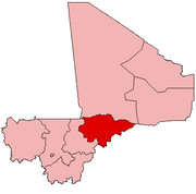
 Madiama Location in Mali | |
| Coordinates: 13°48′N 4°24′W / 13.800°N 4.400°WCoordinates: 13°48′N 4°24′W / 13.800°N 4.400°W | |
| Country |
|
| Region | Mopti Region |
| Cercle | Djenné Cercle |
| Population (2009 Census)[1] | |
| • Total | 12,406 |
| • Ethnicities[2] | Marka, Fulani, Bambara |
| Time zone | GMT (UTC+0) |
Madiama is a rural commune and village in the Cercle of Djenné in the Mopti Region of Mali. The commune contains ten villages.
The commune lies to the west of the main RN6 highway linking Bamako with Gao and is crossed by the spur road linking the highway with the Djenné ferry across the Bani River. The commune is bounded on its west side by the urban commune of Djenné and the commune of Dandougou Fakala.[3]
References
- ↑ Resultats Provisoires RGPH 2009 (Région de Mopti) (PDF) (in French), République de Mali: Institut National de la Statistique.
- ↑ Plan de Sécurité Alimentaire Commune Rurale de Madima 2006-2010 (PDF) (in French), Commissariat à la Sécurité Alimentaire, République du Mali, USAID-Mali, 2006.
- ↑ Plan du Développement Educatif Réactualisé du Cercle de Djenné (PDF) (in French), Académie d’Enseignement de Mopti, Ministère de l’Education National, République du Mali. Coopération Mali/UNICEF, 2004. The report includes low resolution maps obtained from screen-dumps which show the boundaries of communes within the Djenné Cercle.
This article is issued from Wikipedia - version of the 3/8/2013. The text is available under the Creative Commons Attribution/Share Alike but additional terms may apply for the media files.