Magnolia, Minnesota
| Magnolia, Minnesota | |
|---|---|
| Town | |
 Location of Magnolia, Minnesota | |
| Coordinates: 43°38′41″N 96°4′38″W / 43.64472°N 96.07722°W | |
| Country | United States |
| State | Minnesota |
| County | Rock |
| Government | |
| • Type | Mayor - Council |
| • Mayor | Dennis Madison |
| Area[1] | |
| • Total | 0.78 sq mi (2.02 km2) |
| • Land | 0.78 sq mi (2.02 km2) |
| • Water | 0 sq mi (0 km2) |
| Elevation | 1,526 ft (465 m) |
| Population (2010)[2] | |
| • Total | 222 |
| • Estimate (2012[3]) | 219 |
| • Density | 284.6/sq mi (109.9/km2) |
| Time zone | Central (CST) (UTC-6) |
| • Summer (DST) | CDT (UTC-5) |
| ZIP code | 56158 |
| Area code(s) | 507 |
| FIPS code | 27-39338[4] |
| GNIS feature ID | 0647376[5] |
Magnolia is a town in Rock County, Minnesota, United States. The population was 222 at the 2010 census.[6]
History
A post office called Magnolia has been in operation since 1886.[7] Magnolia was platted in 1891.[8] The town took its name from Magnolia Township.[9] Magnolia was incorporated in 1894.[8]
Geography
According to the United States Census Bureau, the city has a total area of 0.78 square miles (2.02 km2), all of it land.[1]
Demographics
| Historical population | |||
|---|---|---|---|
| Census | Pop. | %± | |
| 1900 | 176 | — | |
| 1910 | 189 | 7.4% | |
| 1920 | 219 | 15.9% | |
| 1930 | 240 | 9.6% | |
| 1940 | 273 | 13.8% | |
| 1950 | 260 | −4.8% | |
| 1960 | 280 | 7.7% | |
| 1970 | 233 | −16.8% | |
| 1980 | 234 | 0.4% | |
| 1990 | 155 | −33.8% | |
| 2000 | 221 | 42.6% | |
| 2010 | 222 | 0.5% | |
| Est. 2015 | 219 | [10] | −1.4% |
2010 census
As of the census[2] of 2010, there were 222 people, 77 households, and 56 families residing in the city. The population density was 284.6 inhabitants per square mile (109.9/km2). There were 84 housing units at an average density of 107.7 per square mile (41.6/km2). The racial makeup of the city was 81.5% White, 1.4% African American, 4.5% Native American, 8.6% Asian, 1.8% from other races, and 2.3% from two or more races. Hispanic or Latino of any race were 2.3% of the population.
There were 77 households of which 29.9% had children under the age of 18 living with them, 57.1% were married couples living together, 11.7% had a female householder with no husband present, 3.9% had a male householder with no wife present, and 27.3% were non-families. 26.0% of all households were made up of individuals and 7.8% had someone living alone who was 65 years of age or older. The average household size was 2.49 and the average family size was 2.93.
The median age in the city was 33 years. 30.2% of residents were under the age of 18; 10.5% were between the ages of 18 and 24; 22.2% were from 25 to 44; 26.2% were from 45 to 64; and 11.3% were 65 years of age or older. The gender makeup of the city was 58.6% male and 41.4% female.
2000 census
As of the census[4] of 2000, there were 221 people, 79 households, and 57 families residing in the town. The population density was 215.6 people per square mile (82.8/km²). There were 87 housing units at an average density of 84.9 per square mile (32.6/km²). The racial makeup of the town was 82.81% White, 2.71% African American, 9.50% Asian, 0.45% Pacific Islander, and 4.52% from two or more races. Hispanic or Latino of any race were 4.98% of the population.
There were 79 households out of which 36.7% had children under the age of 18 living with them, 64.6% were married couples living together, 6.3% had a female householder with no husband present, and 26.6% were non-families. 22.8% of all households were made up of individuals and 11.4% had someone living alone who was 65 years of age or older. The average household size was 2.80 and the average family size was 3.31.
In the town the population was spread out with 33.5% under the age of 18, 5.4% from 18 to 24, 28.1% from 25 to 44, 19.5% from 45 to 64, and 13.6% who were 65 years of age or older. The median age was 34 years. For every 100 females there were 92.2 males. For every 100 females age 18 and over, there were 86.1 males.
The median income for a household in the town was $36,000, and the median income for a family was $36,500. Males had a median income of $30,500 versus $21,875 for females. The per capita income for the townwas $13,427. About 5.2% of families and 6.1% of the population were below the poverty line, including 5.7% of those under the age of eighteen and none of those sixty five or over.
Politics
Magnolia is located in Minnesota's 1st congressional district, represented by Mankato educator Tim Walz, a Democrat. At the state level, Magnolia is located in Senate District 22, represented by Republican Doug Magnus, and in House District 22A, represented by Republican Joe Schomacker.
References
- 1 2 "US Gazetteer files 2010". United States Census Bureau. Retrieved 2012-11-13.
- 1 2 "American FactFinder". United States Census Bureau. Retrieved 2012-11-13.
- ↑ "Population Estimates". United States Census Bureau. Retrieved 2013-05-28.
- 1 2 "American FactFinder". United States Census Bureau. Retrieved 2008-01-31.
- ↑ "US Board on Geographic Names". United States Geological Survey. 2007-10-25. Retrieved 2008-01-31.
- ↑ "2010 Census Redistricting Data (Public Law 94-171) Summary File". American FactFinder. United States Census Bureau. Retrieved 27 April 2011.
- ↑ "Rock County". Jim Forte Postal History. Retrieved 4 April 2015.
- 1 2 Upham, Warren (1920). Minnesota Geographic Names: Their Origin and Historic Significance. Minnesota Historical Society. p. 468.
- ↑ Chicago and North Western Railway Company (1908). A History of the Origin of the Place Names Connected with the Chicago & North Western and Chicago, St. Paul, Minneapolis & Omaha Railways. p. 182.
- ↑ "Annual Estimates of the Resident Population for Incorporated Places: April 1, 2010 to July 1, 2015". Retrieved July 2, 2016.
- ↑ "Census of Population and Housing". Census.gov. Retrieved June 4, 2015.
External links
Municipalities and communities of Rock County, Minnesota, United States | ||
|---|---|---|
| Cities | 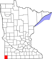 | |
| Townships | ||
| Unincorporated communities | ||
| Ghost towns | ||
| Footnotes | ‡This populated place also has portions in an adjacent county or counties | |
Coordinates: 43°38′43″N 96°04′45″W / 43.64528°N 96.07917°W