Maida, North Dakota
| Maida, North Dakota | |
|---|---|
| Unincorporated community | |
 Maida  Maida Location within the state of North Dakota | |
| Coordinates: 48°59′55″N 98°21′53″W / 48.99861°N 98.36472°WCoordinates: 48°59′55″N 98°21′53″W / 48.99861°N 98.36472°W | |
| Country | United States |
| State | North Dakota |
| County | Cavalier |
| Elevation | 1,562 ft (476 m) |
| Time zone | Central (CST) (UTC-6) |
| • Summer (DST) | CDT (UTC-5) |
| ZIP codes | 58255 |
| GNIS feature ID | 1030066 |
Maida (also Seven Lakes) is an unincorporated community in northern Cavalier County, North Dakota, United States. It lies along North Dakota Highway 1, north of the city of Langdon, the county seat of Cavalier County.[1] Its elevation is 1,562 feet (476 m). Maida serves as a port of entry between Canada and the United States.[2]
Various possibilities have been suggested for the etymology of the name "Maida":[3][4]
- A book read by Charles Howatt, the first postmaster
- Suggested by two Canadian bankers from a dog in a novel by Sir Walter Scott
- A clipping of "maiden" name for a haymeadow
Maida's post office was established in September 1884 and became a Rural Branch of Langdon in April 1967; the community still has its own ZIP code of 58255.[5][6]
References
- ↑ Rand McNally. The Road Atlas '08. Chicago: Rand McNally, 2008, p. 77.
- ↑ "Port Of Entry-Maida". U.S. Customs and Border Protection. Retrieved 2009-07-28.
- ↑ U.S. Geological Survey Geographic Names Information System: Maida, North Dakota, Geographic Names Information System, 1980-02-13. Accessed 2008-03-28.
- ↑ Wick, Douglas A. North Dakota Place Names. Hedemarken Collectibles. ISBN 0-9620968-0-6.
- ↑ Patera, Alan H. & Gallagher, John S. (1982). North Dakota Post Offices 1850-1982. Burtonsville, Maryland: The Depot. p. 46.
- ↑ Zip Code Lookup
Municipalities and communities of Cavalier County, North Dakota, United States | ||
|---|---|---|
| Cities | 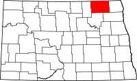 | |
| Townships |
| |
| Unincorporated communities |
| |
| Footnotes | ‡This populated place also has portions in an adjacent county or counties | |
This article is issued from Wikipedia - version of the 7/31/2016. The text is available under the Creative Commons Attribution/Share Alike but additional terms may apply for the media files.