Main and Military Plazas Historic District
|
Main and Military Plazas Historic District | |
|
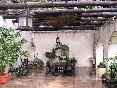
Spanish Military Governor's Palace | |
  | |
| Location | Roughly bounded by San Antonio River, E. Nueva, Laredo, and Houston Streets, San Antonio, Texas |
|---|---|
| Coordinates | 29°25′27″N 98°29′37″W / 29.42417°N 98.49361°WCoordinates: 29°25′27″N 98°29′37″W / 29.42417°N 98.49361°W |
| Built | 1722 |
| Architect | Multiple |
| Architectural style | Early commercial, Late Victorian, Spanish Colonial |
| NRHP Reference # | 79002914 |
| Added to NRHP | June 11, 1979[1] |

Main Plaza, Cathedral, and Court House, San Antonio, Texas (postcard, circa, 1901-1914)
Main and Military Plazas Historic District is a historic district in San Antonio, Texas. It was listed on the National Register of Historic Places in 1979.[1]
The area encompasses the old Presidio San Antonio de Béxar,[2] where the Spanish troops and the military governor of Texas were stationed.[3]
It includes the following separately-listed Registered Historic Places, one or more of which are National Historic Landmarks:
- Spanish Governor's Palace,
- Vogel Belt Building Complex (restored for city offices),
- Church of Nuestra Señora de la Candelaria y Guadalupe, also known as the Cathedral of San Fernando
- Bexar County Courthouse
See also
- Holiday Inn Express Riverwalk Area, a contributing structure, formerly the county jail
- Alamo Plaza Historic District
References
- 1 2 National Park Service (2008-04-15). "National Register Information System". National Register of Historic Places. National Park Service.
- ↑ "SAN ANTONIO DE BEXAR PRESIDIO," Handbook of Texas Online (http://www.tshaonline.org/handbook/online/articles/uqs02), accessed April 23, 2011. Published by the Texas State Historical Association.
- ↑ Edmonson (2000), p. 14.
Citations
- Edmondson, J.R. (2000), The Alamo Story-From History to Current Conflicts, Plano, TX: Republic of Texas Press, ISBN 1-55622-678-0

This article is issued from Wikipedia - version of the 11/26/2016. The text is available under the Creative Commons Attribution/Share Alike but additional terms may apply for the media files.