Maligne River
| Maligne River | |
|---|---|
|
The Maligne River River north of Maligne Lake | |
| Country |
|
| Basin | |
| Main source |
Replica Peak 2,048 m (6,719 ft) 52°32′01″N 117°28′30″W / 52.53361°N 117.47500°W |
| River mouth |
Athabasca River 1,019 m (3,343 ft) 52°56′02″N 118°01′59″W / 52.93389°N 118.03306°WCoordinates: 52°56′02″N 118°01′59″W / 52.93389°N 118.03306°W |

The Maligne River (/məˈliːn/ mə-LEEN)[1] is a medium-sized river in the Canadian Rockies. It runs through parts of Jasper National Park in Alberta, Canada. The Maligne is a major tributary of the Athabasca River. The river takes from the French word for malignant or wicked. It is theorised that an early French voyageur created this name in reference to the current of the river near its confluence with the Athabasca River.[2]
Geography
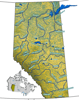
The Maligne River begins south of Maligne Lake. Forming from the meltwater of Replica Peak, the river heads north, passing under Mount Mary Vaux, Lysfran Peak, Mount Unwin, and Mount Charleton before emptying into Maligne Lake. The Maligne River drains the north end of Maligne Lake and heads northwest to Medicine Lake. It then flows west, entering the Athabasca River.[3]
Gallery
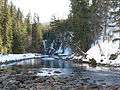 The Maligne River downstream of Maligne Lake
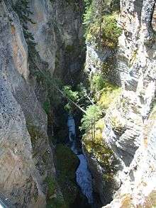
References
- ↑ Merriam-Webster's Geographical Dictionary, 3rd ed. (Springfield, MA: Merriam-Webster, 1997; ISBN 0877795460), p. 696.
- ↑ Karamitsanis, Aphrodite (1991). Place Names of Alberta, Volume 1. Calgary: University of Calgary Press, pg. 153
- ↑ Mussio Ventures. Central Alberta Backroad Mapbook. Burnaby: Backroad Mapbooks (2002)