Malta Bend, Missouri
| Malta Bend, Missouri | |
|---|---|
| City | |
 Location of Malta Bend, Missouri | |
| Coordinates: 39°11′39″N 93°21′43″W / 39.19417°N 93.36194°WCoordinates: 39°11′39″N 93°21′43″W / 39.19417°N 93.36194°W | |
| Country | United States |
| State | Missouri |
| County | Saline |
| Area[1] | |
| • Total | 0.25 sq mi (0.65 km2) |
| • Land | 0.25 sq mi (0.65 km2) |
| • Water | 0 sq mi (0 km2) |
| Elevation | 699 ft (213 m) |
| Population (2010)[2] | |
| • Total | 250 |
| • Estimate (2012[3]) | 251 |
| • Density | 1,000.0/sq mi (386.1/km2) |
| Time zone | Central (CST) (UTC-6) |
| • Summer (DST) | CDT (UTC-5) |
| ZIP code | 65339 |
| Area code(s) | 660 |
| FIPS code | 29-45632[4] |
| GNIS feature ID | 0721779[5] |
Malta Bend is a city in Saline County, Missouri, United States. The population was 250 at the 2010 census.
History
Malta Bend was laid out in 1865. It was named for the steamer Malta, which was sunk in a bend of the Missouri River about 3 miles (4.8 km) from the city.[6]
Geography
Malta Bend is located at 39°11′39″N 93°21′43″W / 39.19417°N 93.36194°W (39.194254, -93.362065).[7] According to the United States Census Bureau, the city has a total area of 0.25 square miles (0.65 km2), all of it land.[1]
The land is surrounded on three sides by the Missouri river. The average alluvial soil depth (top soil) is 25 ft.
Demographics
| Historical population | |||
|---|---|---|---|
| Census | Pop. | %± | |
| 1880 | 412 | — | |
| 1890 | 449 | 9.0% | |
| 1900 | 431 | −4.0% | |
| 1910 | 399 | −7.4% | |
| 1920 | 442 | 10.8% | |
| 1930 | 429 | −2.9% | |
| 1940 | 355 | −17.2% | |
| 1950 | 414 | 16.6% | |
| 1960 | 338 | −18.4% | |
| 1970 | 342 | 1.2% | |
| 1980 | 292 | −14.6% | |
| 1990 | 289 | −1.0% | |
| 2000 | 249 | −13.8% | |
| 2010 | 250 | 0.4% | |
| Est. 2015 | 251 | [8] | 0.4% |
2010 census
As of the census[2] of 2010, there were 250 people, 98 households, and 69 families residing in the city. The population density was 1,000.0 inhabitants per square mile (386.1/km2). There were 110 housing units at an average density of 440.0 per square mile (169.9/km2). The racial makeup of the city was 96.4% White, 1.2% African American, 1.6% from other races, and 0.8% from two or more races. Hispanic or Latino of any race were 2.0% of the population.
There were 98 households of which 35.7% had children under the age of 18 living with them, 50.0% were married couples living together, 14.3% had a female householder with no husband present, 6.1% had a male householder with no wife present, and 29.6% were non-families. 28.6% of all households were made up of individuals and 10.2% had someone living alone who was 65 years of age or older. The average household size was 2.55 and the average family size was 3.09.
The median age in the city was 39.6 years. 25.2% of residents were under the age of 18; 8.8% were between the ages of 18 and 24; 26% were from 25 to 44; 27.2% were from 45 to 64; and 12.8% were 65 years of age or older. The gender makeup of the city was 49.6% male and 50.4% female.
2000 census
As of the census[4] of 2000, there were 249 people, 93 households, and 66 families residing in the town. The population density was 948.8 people per square mile (369.8/km²). There were 104 housing units at an average density of 396.3 per square mile (154.4/km²). The racial makeup of the town was 97.99% White, 1.61% African American, and 0.40% from two or more races.
There were 93 households out of which 34.4% had children under the age of 18 living with them, 55.9% were married couples living together, 8.6% had a female householder with no husband present, and 29.0% were non-families. 28.0% of all households were made up of individuals and 12.9% had someone living alone who was 65 years of age or older. The average household size was 2.68 and the average family size was 3.26.
In the town the population was spread out with 34.1% under the age of 18, 7.2% from 18 to 24, 26.1% from 25 to 44, 18.9% from 45 to 64, and 13.7% who were 65 years of age or older. The median age was 32 years. For every 100 females there were 112.8 males. For every 100 females age 18 and over, there were 102.5 males.
The median income for a household in the town was $27,250, and the median income for a family was $34,063. Males had a median income of $28,611 versus $21,563 for females. The per capita income for the town was $14,403. About 13.3% of families and 11.3% of the population were below the poverty line, including 14.8% of those under the age of eighteen and 4.7% of those sixty five or over.
References
- 1 2 "US Gazetteer files 2010". United States Census Bureau. Retrieved 2012-07-08.
- 1 2 "American FactFinder". United States Census Bureau. Retrieved 2012-07-08.
- ↑ "Population Estimates". United States Census Bureau. Retrieved 2013-05-30.
- 1 2 "American FactFinder". United States Census Bureau. Retrieved 2008-01-31.
- ↑ "US Board on Geographic Names". United States Geological Survey. 2007-10-25. Retrieved 2008-01-31.
- ↑ Eaton, David Wolfe (1918). How Missouri Counties, Towns and Streams Were Named. The State Historical Society of Missouri. p. 361.
- ↑ "US Gazetteer files: 2010, 2000, and 1990". United States Census Bureau. 2011-02-12. Retrieved 2011-04-23.
- ↑ "Annual Estimates of the Resident Population for Incorporated Places: April 1, 2010 to July 1, 2015". Retrieved July 2, 2016.
- ↑ "Census of Population and Housing". Census.gov. Retrieved June 4, 2015.
External links
- Historic maps of Malta Bend in the Sanborn Maps of Missouri Collection at the University of Missouri
Municipalities and communities of Saline County, Missouri, United States | ||
|---|---|---|
| Cities | 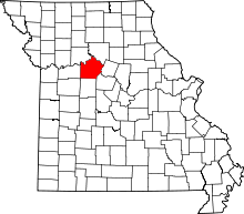 | |
| Villages | ||
| Townships |
| |
| Unincorporated communities | ||
| Footnotes | ‡This populated place also has portions in an adjacent county or counties | |