Manantiales, Uruguay
| Manantiales | |
|---|---|
| Resort | |
 Manantiales Location in Uruguay | |
| Coordinates: 34°54′20″S 54°49′30″W / 34.90556°S 54.82500°WCoordinates: 34°54′20″S 54°49′30″W / 34.90556°S 54.82500°W | |
| Country |
|
| Department | Maldonado Department |
| Population (2011) | |
| • Total | 149 |
| Time zone | UTC -3 |
| Postal code | 20002 |
| Dial plan | +598 42 (+6 digits) |
Manantiales is a resort (balneario) in the Maldonado Department of southeastern Uruguay.
Location and geography
The resort is located on the coast of the Atlantic Ocean, on Route 10, between its junction with Route 104 to the east and Laguna Blanca (which means White Lagoon) to the west. On its coastline is a small point called Punta Piedras. To the west of this point is the beach Las Olas Playa and to its east the beach Playa Bikini. To the west, it borders a neighbourhood called "Barrio San Carlos",[1] which lies just east of the resort La Barra, and to the east it borders the resort El Chorro.
Population
In 2011 Manantiales had a population of 149 permanent inhabitants and 486 dwellings.[2]
| Year | Population | Dwellings |
|---|---|---|
| 1963 | 57 | 117 |
| 1975 | 63 | 177 |
| 1985 | 132 | 307 |
| 1996 | 199 | 419 |
| 2004 | 182 | 452 |
| 2011 | 149 | 486 |
Source: Instituto Nacional de Estadística de Uruguay[3]
References
- ↑ "Municipal map of Maldonado" (PDF (1.2 MB)). Intendencia de Maldonado. Retrieved 26 July 2011.
- ↑ "Censos 2011 Maldonado (needs flash plugin)". INE. 2012. Retrieved 29 August 2012.
- ↑ "1963–1996 Statistics / M" (DOC). Instituto Nacional de Estadística de Uruguay. 2004. Retrieved 25 July 2011.
External links
- Article on Manantiales, Official Portal of the Uruguayan Government
- INE map of El Tesoro, La Barra, Laguna Blanca, Manantiales and El Chorro
| Resorts and Landforms |
|
|---|---|
Glossary : Balneario = Resort , Barra = Mouth (of river) , Laguna = Lagoon , Playa = Beach , Puerto = Port , Punta (or Pta) = Point, Small Peninsula | |
Capital: | ||
| Towns and villages | 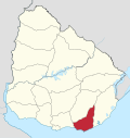 | |
| Sights | ||
This article is issued from Wikipedia - version of the 10/14/2014. The text is available under the Creative Commons Attribution/Share Alike but additional terms may apply for the media files.