Maringouin, Louisiana
| Town of Maringouin | |
| Town | |
.jpg) | |
| Country | United States |
|---|---|
| State | Louisiana |
| Parish | Iberville |
| Elevation | 20 ft (6.1 m) |
| Coordinates | 30°29′27″N 91°31′08″W / 30.49083°N 91.51889°WCoordinates: 30°29′27″N 91°31′08″W / 30.49083°N 91.51889°W |
| Area | 0.8 sq mi (2.1 km2) |
| - land | 0.8 sq mi (2 km2) |
| - water | 0.0 sq mi (0 km2), 0% |
| Population | 1,262 (2000) |
| Density | 1,691.3/sq mi (653.0/km2) |
| Mayor | Demi Vorise (D) |
| Timezone | CST (UTC-6) |
| - summer (DST) | CDT (UTC-5) |
| Area code | 225 |
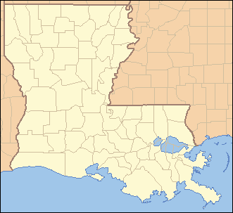 Location of Maringouin in Louisiana | |
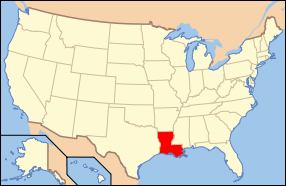 Location of Louisiana in the United States | |
Maringouin is a town in Iberville Parish, Louisiana, United States. The population was 1,262 at the 2000 census. It is part of the Baton Rouge Metropolitan Statistical Area.
Geography
Maringouin is located at 30°29′27″N 91°31′8″W / 30.49083°N 91.51889°W (30.490911, -91.519023).[1]
According to the United States Census Bureau, the town has a total area of 0.8 square miles (2.1 km2), all land.
Notable people
Rick Ward, III, state senator from District 17 since 2012 and attorney in Port Allen, resides in Maringouin,[2]
Demographics
| Historical population | |||
|---|---|---|---|
| Census | Pop. | %± | |
| 1910 | 447 | — | |
| 1920 | 399 | −10.7% | |
| 1930 | 518 | 29.8% | |
| 1940 | 708 | 36.7% | |
| 1950 | 898 | 26.8% | |
| 1960 | 1,168 | 30.1% | |
| 1970 | 1,365 | 16.9% | |
| 1980 | 1,291 | −5.4% | |
| 1990 | 1,149 | −11.0% | |
| 2000 | 1,262 | 9.8% | |
| 2010 | 1,098 | −13.0% | |
| Est. 2015 | 1,061 | [3] | −3.4% |
As of the census[5] of 2000, there were 1,262 people, 421 households, and 327 families residing in the town. The population density was 1,691.3 people per square mile (649.7/km²). There were 458 housing units at an average density of 613.8 per square mile (235.8/km²). The racial makeup of the town was 20.13% White, 79.40% African American, 0.08% from other races, and 0.40% from two or more races. Hispanic or Latino of any race were 0.08% of the population.
There were 421 households out of which 40.4% had children under the age of 18 living with them, 44.7% were married couples living together, 27.6% had a female householder with no husband present, and 22.1% were non-families. 20.2% of all households were made up of individuals and 11.6% had someone living alone who was 65 years of age or older. The average household size was 3.00 and the average family size was 3.43.
In the town the population was spread out with 33.1% under the age of 18, 9.3% from 18 to 24, 24.3% from 25 to 44, 20.2% from 45 to 64, and 13.1% who were 65 years of age or older. The median age was 32 years. For every 100 females there were 80.8 males. For every 100 females age 18 and over, there were 73.7 males.
The median income for a household in the town was $23,816, and the median income for a family was $28,359. Males had a median income of $27,917 versus $19,500 for females. The per capita income for the town was $10,817. About 27.5% of families and 31.5% of the population were below the poverty line, including 39.2% of those under age 18 and 22.1% of those age 65 or over.
Other information
The name, which is Cajun French in origin and means "mosquito", is pronounced mah-ring-gwin.
References
- ↑ "US Gazetteer files: 2010, 2000, and 1990". United States Census Bureau. 2011-02-12. Retrieved 2011-04-23.
- ↑ "Senator Rick Ward, III". labi.org. Retrieved July 17, 2013.
- ↑ "Annual Estimates of the Resident Population for Incorporated Places: April 1, 2010 to July 1, 2015". Retrieved July 2, 2016.
- ↑ "Census of Population and Housing". Census.gov. Retrieved June 4, 2015.
- ↑ "American FactFinder". United States Census Bureau. Retrieved 2008-01-31.
Municipalities and communities of Iberville Parish, Louisiana, United States | ||
|---|---|---|
| Cities | 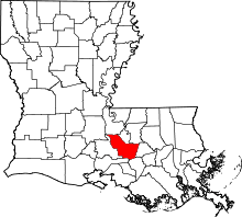 | |
| Towns | ||
| Villages | ||
| CDPs |
| |
| Other unincorporated communities |
| |
| Ghost towns | ||