Marion, Wisconsin
| Marion, Wisconsin | |
|---|---|
| City | |
 Location of Marion, Wisconsin | |
| Coordinates: 44°40′21″N 88°53′11″W / 44.67250°N 88.88639°WCoordinates: 44°40′21″N 88°53′11″W / 44.67250°N 88.88639°W | |
| Country | United States |
| State | Wisconsin |
| Counties | Waupaca, Shawano |
| Area[1] | |
| • Total | 2.58 sq mi (6.68 km2) |
| • Land | 2.45 sq mi (6.35 km2) |
| • Water | 0.13 sq mi (0.34 km2) |
| Elevation[2] | 850 ft (259 m) |
| Population (2010)[3] | |
| • Total | 1,260 |
| • Estimate (2012[4]) | 1,244 |
| • Density | 514.3/sq mi (198.6/km2) |
| Time zone | Central (CST) (UTC-6) |
| • Summer (DST) | CDT (UTC-5) |
| Area code(s) | 715 & 534 |
| FIPS code | 55-49400[5] |
| GNIS feature ID | 1569041[2] |
| Website |
marion |
Marion is a city in Shawano and Waupaca counties in the U.S. state of Wisconsin. The population was 1,260 at the 2010 census.
History
A post office called Marion has been in operation since 1880.[6] The city was named for Francis Marion, an officer in the American Revolutionary War.[7]
Geography
Marion is located at 44°40′21″N 88°53′11″W / 44.67250°N 88.88639°W (44.672573, -88.886284).[8]
According to the United States Census Bureau, the city has a total area of 2.58 square miles (6.68 km2), of which, 2.45 square miles (6.35 km2) is land and 0.13 square miles (0.34 km2) is water.[1] Most of the city lies in Waupaca County, with only a small portion extending into Shawano County.
Demographics
| Historical population | |||
|---|---|---|---|
| Census | Pop. | %± | |
| 1880 | 161 | — | |
| 1890 | 470 | 191.9% | |
| 1900 | 602 | 28.1% | |
| 1910 | 798 | 32.6% | |
| 1920 | 875 | 9.6% | |
| 1930 | 992 | 13.4% | |
| 1940 | 1,034 | 4.2% | |
| 1950 | 1,118 | 8.1% | |
| 1960 | 1,200 | 7.3% | |
| 1970 | 1,218 | 1.5% | |
| 1980 | 1,348 | 10.7% | |
| 1990 | 1,242 | −7.9% | |
| 2000 | 1,297 | 4.4% | |
| 2010 | 1,260 | −2.9% | |
| Est. 2015 | 1,220 | [9] | −3.2% |
2010 census
As of the census[3] of 2010, there were 1,260 people, 538 households, and 351 families residing in the city. The population density was 514.3 inhabitants per square mile (198.6/km2). There were 617 housing units at an average density of 251.8 per square mile (97.2/km2). The racial makeup of the city was 97.4% White, 0.1% African American, 1.5% Native American, 0.1% Asian, 0.3% from other races, and 0.6% from two or more races. Hispanic or Latino of any race were 1.7% of the population.
There were 538 households of which 29.9% had children under the age of 18 living with them, 49.8% were married couples living together, 9.3% had a female householder with no husband present, 6.1% had a male householder with no wife present, and 34.8% were non-families. 27.9% of all households were made up of individuals and 17.8% had someone living alone who was 65 years of age or older. The average household size was 2.34 and the average family size was 2.79.
The median age in the city was 40.5 years. 23.3% of residents were under the age of 18; 7.9% were between the ages of 18 and 24; 23.2% were from 25 to 44; 25% were from 45 to 64; and 20.5% were 65 years of age or older. The gender makeup of the city was 45.6% male and 54.4% female.
2000 census
As of the census[5] of 2000, there were 1,297 people, 581 households, and 367 families residing in the city. The population density was 611.7 people per square mile (236.2/km²). There were 624 housing units at an average density of 294.3 per square mile (113.6/km²). The racial makeup of the city was 99.38% White, 0.08% African American, 0.23% Native American, 0.15% Asian, and 0.15% from two or more races. Hispanic or Latino of any race were 0.08% of the population.
There were 581 households out of which 25.6% had children under the age of 18 living with them, 53.4% were married couples living together, 7.4% had a female householder with no husband present, and 36.7% were non-families. 32.5% of all households were made up of individuals and 19.3% had someone living alone who was 65 years of age or older. The average household size was 2.23 and the average family size was 2.82.
In the city the population was spread out with 21.2% under the age of 18, 7.9% from 18 to 24, 26.4% from 25 to 44, 21.8% from 45 to 64, and 22.7% who were 65 years of age or older. The median age was 41 years. For every 100 females there were 90.5 males. For every 100 females age 18 and over, there were 87.9 males.
The median income for a household in the city was $32,344, and the median income for a family was $41,688. Males had a median income of $29,279 versus $21,974 for females. The per capita income for the city was $18,391. About 3.4% of families and 6.9% of the population were below the poverty line, including 8.1% of those under age 18 and 9.7% of those age 65 or over.
References
- 1 2 "US Gazetteer files 2010". United States Census Bureau. Retrieved 2012-11-18.
- 1 2 "US Board on Geographic Names". United States Geological Survey. 2007-10-25. Retrieved 2008-01-31.
- 1 2 "American FactFinder". United States Census Bureau. Retrieved 2012-11-18.
- ↑ "Population Estimates". United States Census Bureau. Retrieved 2013-06-24.
- 1 2 "American FactFinder". United States Census Bureau. Retrieved 2008-01-31.
- ↑ "Waupaca County". Jim Forte Postal History. Retrieved 22 March 2015.
- ↑ Chicago and North Western Railway Company (1908). A History of the Origin of the Place Names Connected with the Chicago & North Western and Chicago, St. Paul, Minneapolis & Omaha Railways. p. 99.
- ↑ "US Gazetteer files: 2010, 2000, and 1990". United States Census Bureau. 2011-02-12. Retrieved 2011-04-23.
- ↑ "Annual Estimates of the Resident Population for Incorporated Places: April 1, 2010 to July 1, 2015". Retrieved July 2, 2016.
- ↑ "Census of Population and Housing". Census.gov. Retrieved June 4, 2015.
External links
- City of Marion
- Sanborn fire insurance maps: 1894 1901 1909
| Wikimedia Commons has media related to Marion, Wisconsin. |
Municipalities and communities of Shawano County, Wisconsin, United States | ||
|---|---|---|
| Cities | 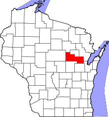 | |
| Villages | ||
| Towns | ||
| CDPs | ||
| Unincorporated communities | ||
| Indian reservations | ||
| Footnotes | ‡This populated place also has portions in an adjacent county or counties | |
Municipalities and communities of Waupaca County, Wisconsin, United States | ||
|---|---|---|
| Cities | 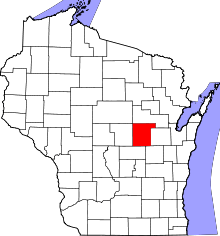 | |
| Villages | ||
| Towns | ||
| CDPs | ||
| Unincorporated communities | ||
| Ghost towns | ||
| Footnotes | ‡This populated place also has portions in an adjacent county or counties | |