Marshall County, South Dakota
| Marshall County, South Dakota | |
|---|---|
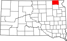 Location in the U.S. state of South Dakota | |
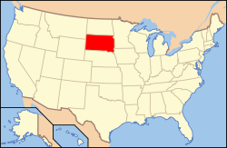 South Dakota's location in the U.S. | |
| Founded | 1885[1] |
| Named for | Marshall Vincent |
| Seat | Britton |
| Largest city | Britton |
| Area | |
| • Total | 886 sq mi (2,295 km2) |
| • Land | 838 sq mi (2,170 km2) |
| • Water | 48 sq mi (124 km2), 5.4% |
| Population (est.) | |
| • (2015) | 4,769 |
| • Density | 5.4/sq mi (2/km²) |
| Congressional district | At-large |
| Time zone | Central: UTC-6/-5 |
Marshall County is a county located in the U.S. state of South Dakota. As of the 2010 census, the population was 4,656.[2] Its county seat is Britton.[3] The county is named after Marshall Vincent, who homesteaded near Andover, South Dakota.[1]
Geography
According to the U.S. Census Bureau, the county has a total area of 886 square miles (2,290 km2), of which 838 square miles (2,170 km2) is land and 48 square miles (120 km2) (5.4%) is water.[4]
Major Highways
Adjacent Counties
- Sargent County, North Dakota - north
- Roberts County, South Dakota - east
- Day County, South Dakota - south
- Brown County, South Dakota - west
Demographics
| Historical population | |||
|---|---|---|---|
| Census | Pop. | %± | |
| 1890 | 4,544 | — | |
| 1900 | 5,942 | 30.8% | |
| 1910 | 8,021 | 35.0% | |
| 1920 | 9,596 | 19.6% | |
| 1930 | 9,540 | −0.6% | |
| 1940 | 8,880 | −6.9% | |
| 1950 | 7,835 | −11.8% | |
| 1960 | 6,663 | −15.0% | |
| 1970 | 5,965 | −10.5% | |
| 1980 | 5,404 | −9.4% | |
| 1990 | 4,844 | −10.4% | |
| 2000 | 4,576 | −5.5% | |
| 2010 | 4,656 | 1.7% | |
| Est. 2015 | 4,769 | [5] | 2.4% |
| U.S. Decennial Census[6] 1790-1960[7] 1900-1990[8] 1990-2000[9] 2010-2015[2] | |||
2000 census
As of the census[10] of 2000, there were 4,576 people, 1,844 households, and 1,252 families residing in the county. The population density was 6 people per square mile (2/km²). There were 2,562 housing units at an average density of 3 per square mile (1/km²). The racial makeup of the county was 92.59% White, 0.09% Black or African American, 6.32% Native American, 0.09% Asian, 0.22% from other races, and 0.70% from two or more races. 0.76% of the population were Hispanic or Latino of any race.
There were 1,844 households out of which 29.80% had children under the age of 18 living with them, 57.20% were married couples living together, 6.50% had a female householder with no husband present, and 32.10% were non-families. 30.10% of all households were made up of individuals and 16.10% had someone living alone who was 65 years of age or older. The average household size was 2.43 and the average family size was 3.04.
In the county, the population was spread out with 27.00% under the age of 18, 5.10% from 18 to 24, 22.80% from 25 to 44, 23.80% from 45 to 64, and 21.30% who were 65 years of age or older. The median age was 42 years. For every 100 females there were 100.00 males. For every 100 females age 18 and over, there were 96.80 males.
The median income for a household in the county was $30,567, and the median income for a family was $36,295. Males had a median income of $27,241 versus $17,872 for females. The per capita income for the county was $15,462. About 10.40% of families and 13.90% of the population were below the poverty line, including 19.00% of those under age 18 and 14.00% of those age 65 or over.
2010 census
As of the 2010 United States Census, there were 4,656 people, 1,815 households, and 1,154 families residing in the county.[11] The population density was 5.6 inhabitants per square mile (2.2/km2). There were 2,534 housing units at an average density of 3.0 per square mile (1.2/km2).[12] The racial makeup of the county was 85.4% white, 7.6% American Indian, 0.2% black or African American, 0.2% Asian, 5.6% from other races, and 1.1% from two or more races. Those of Hispanic or Latino origin made up 6.8% of the population.[11] In terms of ancestry, 45.6% were German, 30.6% were Norwegian, 6.8% were Swedish, 5.8% were Irish, 5.2% were English, and 2.7% were American.[13]
Of the 1,815 households, 24.4% had children under the age of 18 living with them, 52.8% were married couples living together, 6.0% had a female householder with no husband present, 36.4% were non-families, and 31.4% of all households were made up of individuals. The average household size was 2.36 and the average family size was 2.83. The median age was 43.2 years.[11]
The median income for a household in the county was $41,023 and the median income for a family was $56,544. Males had a median income of $31,639 versus $26,737 for females. The per capita income for the county was $22,441. About 9.3% of families and 17.1% of the population were below the poverty line, including 27.6% of those under age 18 and 12.8% of those age 65 or over.[14]
Communities
Cities
Towns
Census-designated place
Unincorporated communities
Townships
The county is divided into twenty-five townships:
- Buffalo
- Dayton
- Dumarce
- Eden
- Fort
- Hamilton
- Hickman
- La Belle
- Lake
- Lowell
- McKinley
- Miller
- Newark
- Newport
- Nordland
- Pleasant Valley
- Red Iron Lake
- Sisseton
- Stena
- Veblen
- Victor
- Waverly
- Weston
- White
- Wismer
See also
References
- 1 2 Legislative Manual, South Dakota, 2005, p. 596
- 1 2 "State & County QuickFacts". United States Census Bureau. Retrieved November 25, 2013.
- ↑ "Find a County". National Association of Counties. Retrieved 2011-06-07.
- ↑ "2010 Census Gazetteer Files". United States Census Bureau. August 22, 2012. Retrieved March 28, 2015.
- ↑ "County Totals Dataset: Population, Population Change and Estimated Components of Population Change: April 1, 2010 to July 1, 2015". Retrieved July 2, 2016.
- ↑ "U.S. Decennial Census". United States Census Bureau. Retrieved March 28, 2015.
- ↑ "Historical Census Browser". University of Virginia Library. Retrieved March 28, 2015.
- ↑ Forstall, Richard L., ed. (March 27, 1995). "Population of Counties by Decennial Census: 1900 to 1990". United States Census Bureau. Retrieved March 28, 2015.
- ↑ "Census 2000 PHC-T-4. Ranking Tables for Counties: 1990 and 2000" (PDF). United States Census Bureau. April 2, 2001. Retrieved March 28, 2015.
- ↑ "American FactFinder". United States Census Bureau. Retrieved 2011-05-14.
- 1 2 3 "DP-1 Profile of General Population and Housing Characteristics: 2010 Demographic Profile Data". United States Census Bureau. Retrieved 2016-03-12.
- ↑ "Population, Housing Units, Area, and Density: 2010 - County". United States Census Bureau. Retrieved 2016-03-12.
- ↑ "DP02 SELECTED SOCIAL CHARACTERISTICS IN THE UNITED STATES – 2006-2010 American Community Survey 5-Year Estimates". United States Census Bureau. Retrieved 2016-03-12.
- ↑ "DP03 SELECTED ECONOMIC CHARACTERISTICS – 2006-2010 American Community Survey 5-Year Estimates". United States Census Bureau. Retrieved 2016-03-12.
Coordinates: 45°46′N 97°36′W / 45.76°N 97.60°W
 |
Sargent County, North Dakota | | ||
| Brown County | |
Roberts County | ||
| ||||
| | ||||
| Day County |
Municipalities and communities of Marshall County, South Dakota, United States | ||
|---|---|---|
| Cities | | |
| Towns | ||
| CDP | ||
| Unincorporated communities | ||
| Indian reservation | ||
| Footnotes | ‡This populated place also has portions in an adjacent county or counties | |