Maryovo
| Maryovo (English) Марёво (Russian) | |
|---|---|
|
- Rural locality[1] - Selo[1] | |
|
| |
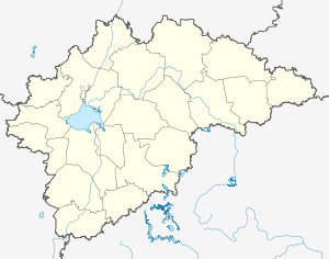
.svg.png) Location of Novgorod Oblast in Russia | |
 Maryovo | |
|
| |
| Administrative status | |
| Country | Russia |
| Federal subject | Novgorod Oblast |
| Administrative district | Maryovsky District[1] |
| settlement | Maryovskoye Settlement[1] |
| Administrative center of | Maryovsky District,[1] Maryovskoye Settlement |
| Municipal status (as of February 2010) | |
| Municipal district | Maryovsky Municipal District[2] |
| Rural settlement | Maryovskoye Rural Settlement[2] |
| Administrative center of | Maryovsky Municipal District,[2] Maryovskoye Rural Settlement[2] |
| Statistics | |
| Population (2010 Census) | 2,297 inhabitants[3] |
| Time zone | MSK (UTC+03:00)[4] |
Maryovo (Russian: Марёво) is a rural locality (a selo) and the administrative center of Maryovsky District of Novgorod Oblast, Russia, located in the south of the oblast, on the Maryovka River, a tributary of the Pola River. Municipally, it is the administrative center of Maryovskoye Rural Settlement. Population: 2,297 (2010 Census);[3] 2,631 (2002 Census);[5] 2,797 (1989 Census).[6]
History
Maryovo was mentioned in a chronicle in 1495 as Maryova. At the time, it was a part of Derevskaya Pyatina of the Novgorod Republic. Between 1612 and 1617, during the Ingrian War, it was occupied by Polish and Swedish troops. By 1620, it was completely depopulated and had to be repopulated again.[7] In the course of the administrative reform carried out in 1708 by Peter the Great, the area was included into Ingermanland Governorate (known since 1710 as Saint Petersburg Governorate). In 1727, separate Novgorod Governorate was split off. Until and 1824, Maryovo was a part of Starorussky Uyezd of Novgorod Viceroyalty (since 1796 of Novgorod Governorate). In 1824, it was transferred to Demyansky Uyezd, which was split off Starorussky Uyezd.[8]
On August 1, 1927, the uyezds were abolished, and Molvotitsky District was established, with the center in the selo of Molvotitsy. Novgorod Governorate was abolished as well, and the district belonged to Novgorod Okrug of Leningrad Oblast. Maryovo was part of Molvotitsky District. On July 23, 1930 the okrugs were abolished, and the districts became directly subordinate to the oblast. During World War II it was occupied by German troops. On February 19, 1944 the district center was transferred from Molvotitsy to Maryovo. On July 5, 1944, Molvotitsky District was transferred to newly established Novgorod Oblast.[8] On December 10, 1962 Molvotitsky District was abolished, and Maryovo became a part of Demyansky District. On December 30 the district was re-established as Maryovsky District, and Maryovo became the district center again.[9]
Economy
Industry
The economy of Maryovo, as well as of the whole district, is based on timber industry.[10]
Transportation
Maryovo is connected by roads to Demyansk and Kholm. Through these localities, it has access to Veliky Novgorod and also to M10 highway connecting Moscow and Saint Petersburg. There are also local roads.
Culture and recreation
There are four cultural heritage monuments of local significance in Maryovo. These include an archaeological monument and three monuments to fallen soldiers.[11]
References
Notes
- 1 2 3 4 5 Государственный комитет Российской Федерации по статистике. Комитет Российской Федерации по стандартизации, метрологии и сертификации. №ОК 019-95 1 января 1997 г. «Общероссийский классификатор объектов административно-территориального деления. Код 49 223 819 002», в ред. изменения №259/2014 от 12 декабря 2014 г.. (State Statistics Committee of the Russian Federation. Committee of the Russian Federation on Standardization, Metrology, and Certification. #OK 019-95 January 1, 1997 Russian Classification of Objects of Administrative Division . Code 49 223 819 002, as amended by the Amendment #259/2014 of December 12, 2014. ).
- 1 2 3 4 Law #401-OZ
- 1 2 Russian Federal State Statistics Service (2011). "Всероссийская перепись населения 2010 года. Том 1" [2010 All-Russian Population Census, vol. 1]. Всероссийская перепись населения 2010 года (2010 All-Russia Population Census) (in Russian). Federal State Statistics Service. Retrieved June 29, 2012.
- ↑ Правительство Российской Федерации. Федеральный закон №107-ФЗ от 3 июня 2011 г. «Об исчислении времени», в ред. Федерального закона №271-ФЗ от 03 июля 2016 г. «О внесении изменений в Федеральный закон "Об исчислении времени"». Вступил в силу по истечении шестидесяти дней после дня официального опубликования (6 августа 2011 г.). Опубликован: "Российская газета", №120, 6 июня 2011 г. (Government of the Russian Federation. Federal Law #107-FZ of June 31, 2011 On Calculating Time, as amended by the Federal Law #271-FZ of July 03, 2016 On Amending Federal Law "On Calculating Time". Effective as of after sixty days following the day of the official publication.).
- ↑ Russian Federal State Statistics Service (May 21, 2004). "Численность населения России, субъектов Российской Федерации в составе федеральных округов, районов, городских поселений, сельских населённых пунктов – районных центров и сельских населённых пунктов с населением 3 тысячи и более человек" [Population of Russia, Its Federal Districts, Federal Subjects, Districts, Urban Localities, Rural Localities—Administrative Centers, and Rural Localities with Population of Over 3,000] (XLS). Всероссийская перепись населения 2002 года [All-Russia Population Census of 2002] (in Russian). Retrieved August 9, 2014.
- ↑ Demoscope Weekly (1989). "Всесоюзная перепись населения 1989 г. Численность наличного населения союзных и автономных республик, автономных областей и округов, краёв, областей, районов, городских поселений и сёл-райцентров" [All Union Population Census of 1989: Present Population of Union and Autonomous Republics, Autonomous Oblasts and Okrugs, Krais, Oblasts, Districts, Urban Settlements, and Villages Serving as District Administrative Centers]. Всесоюзная перепись населения 1989 года [All-Union Population Census of 1989] (in Russian). Институт демографии Национального исследовательского университета: Высшая школа экономики [Institute of Demography at the National Research University: Higher School of Economics]. Retrieved August 9, 2014.
- ↑ История (in Russian). Официальный сайт Администрации Марёвского муниципального района. 2012. Retrieved 23 February 2012.
- 1 2 Снытко, О.В.; et al. (2009). С.Д. Трифонов; Т.Б. Чуйкова; Л.В. Федина; А.Э. Дубоносова, eds. Административно-территориальное деление Новгородской губернии и области 1727-1995 гг. Справочник (PDF) (in Russian). Saint Petersburg. p. 115. Retrieved 24 February 2012.
- ↑ Снытко, О.В.; et al. (2009). С.Д. Трифонов; Т.Б. Чуйкова; Л.В. Федина; А.Э. Дубоносова, eds. Административно-территориальное деление Новгородской губернии и области 1727-1995 гг. Справочник (PDF) (in Russian). Saint Petersburg. p. 194. Retrieved 24 February 2012.
- ↑ Концепция социально-экономического развития Марёвского муниципального района на 2011 год и на плановый период 2012 и 2013 годов (in Russian). Администрация Марёвского муниципального района. Retrieved 24 February 2012.
- ↑ Памятники истории и культуры народов Российской Федерации (in Russian). Russian Ministry of Culture. Retrieved 2 June 2016.
Sources
- Новгородская областная Дума. Областной закон №559-ОЗ от 11 ноября 2005 г. «Об административно-территориальном устройстве Новгородской области», в ред. Областного закона №730-ОЗ от 26 февраля 2015 г. «О внесении изменений в Областной закон "Об административно-территориальном устройстве Новгородской области"». Вступил в силу 1 января 2006 г. Опубликован: "Новгородские ведомости", №75, 23 ноября 2005 г. (Novgorod Oblast Duma. Oblast Law #559-OZ of November 11, 2005 On the Administrative-Territorial Structure of Novgorod Oblast, as amended by the Oblast Law #730-OZ of February 26, 2015 On Amending the Oblast Law "On the Administrative-Territorial Structure of Novgorod Oblast". Effective as of January 1, 2006.).
- Администрация Новгородской области. Постановление №121 от 8 апреля 2008 г. «Об реестре административно-территориального устройства области», в ред. Постановления №408 от 4 августа 2014 г. «О внесении изменений в реестр административно-территориального устройства области». Опубликован: "Новгородские ведомости", №49–50, 16 апреля 2008 г. (Administration of Novgorod Oblast. Resolution #121 of April 8, 2008 On the Registry of the Administrative-Territorial Structure of Novgorod Oblast, as amended by the Resolution #408 of August 4, 2014 On Amending the Registry of the Administrative-Territorial Structure of Novgorod Oblast. ).
- Новгородская областная Дума. Областной закон №401-ОЗ от 17 января 2005 г. «Об установлении границ муниципальных образований, входящих в состав территории Марёвского муниципального района, наделении их статусом сельских поселений, определении административных центров и перечня населённых пунктов, входящих в состав территорий поселений», в ред. Областного закона №699-ОЗ от 3 марта 2010 г «О преобразовании некоторых муниципальных образований, входящих в состав территории Марёвского муниципального района, и внесении изменений в некоторые Областные законы». Вступил в силу со дня, следующего за днём официального опубликования. Опубликован: "Новгородские ведомости", №11–12, 26 января 2005 г. (Novgorod Oblast Duma. Oblast Law #401-OZ of January 17, 2005 On Establishing the Borders of the Municipal Formations Within the Territory of Maryovsky Municipal District, on Granting Them the Status of Rural Settlements, on Establishing Their Administrative Centers, and on Compiling the Lists of Inhabited Localities Within the Settlement Territories, as amended by the Oblast Law #699-OZ of March 3, 2010 On the Transformation of Various Municipal Formations Within the Territory of Maryovsky Municipal District and on Amending Various Oblast Laws. Effective as of the day following the day of the official publication.).