Mawana
| Mawana Mawana(मवाना) | |
|---|---|
| Town | |
| Nickname(s): Muhana | |
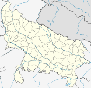 Mawana Location in Uttar Pradesh, India | |
| Coordinates: 29°06′N 77°55′E / 29.10°N 77.92°ECoordinates: 29°06′N 77°55′E / 29.10°N 77.92°E | |
| Country |
|
| State | Uttar Pradesh |
| District | Meerut |
| Elevation | 221 m (725 ft) |
| Population (2001) | |
| • Total | 69,199 |
| Languages | |
| • Official | Hindi |
| Time zone | IST (UTC+5:30) |
| PIN | 250401 |
| Telephone code | 01233 |
| Sex ratio | 900:1000 ♂/♀ |
| Website |
{{URL|example.com|optional display text}} |
Mawana is a town in Meerut district in the Uttar Pradesh state of India. In the northeast side of town is Mawana sugar works. Its name comes from the word "Muhana" means Gateway. It is supposed to be the Muhana of Hastinapur kingdom. Hastinapur is a Mahabharat period town situated nearby.
Demographics
As of 2001 India census,[1] Mawana had a population of 69,199. Males constitute 53% of the population and females 47%. Mawana has an average literacy rate of 53%, lower than the national average of 59.5%: male literacy is 61%, and female literacy is 44%. In Mawana, 17% of the population is under 6 years of age. Mawana contains many castes, 40% Muslims, 60% Hindu and rest others, mawana is bazar for nearer villages Jatav, Yadav (Ahir), chauhan rajputs, Tyagis, Gurjars, jats, baniya (Gupta's & Rastogi's), jains, chauhan are casts which mainly found nearby. Late Thakur Amarpal singh Chauhan 3 times MP from meerut mawana loksabha seat.
Mawana hosts an annual fair "शहीद चंद्रभान प्रदर्शनी" which has eatable stalls, Merry Go Round, Circus and many more attractions.. The details can also be checked out on the website: http://shaheedchandrabhan.org/. The founder of shaheed chandrabhan samiti is Late Th. R.Singh (ret.DSP and a great freedom fighter) now his son Adv. Gajendra Pal Singh Chauhan is the care taker of this society. Ganga the great river is just 10 km. Away from here. Mela makhdumpur is famous for ganga snan,
Pakka talab is also a mahabharatkalin pond. NH-119 joints meerut to mawana then mawana to bijnor.
References
- ↑ "Census of India 2001: Data from the 2001 Census, including cities, villages and towns (Provisional)". Census Commission of India. Archived from the original on 2004-06-16. Retrieved 2008-11-01.