Etah district
| Etah district एटा ज़िला | |
|---|---|
| District of Uttar Pradesh | |
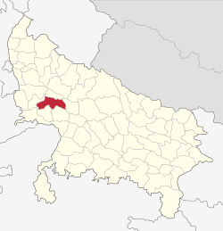 Location of Etah district in Uttar Pradesh | |
| Country | India |
| State | Uttar Pradesh |
| Administrative division | Aligarh |
| Headquarters | Etah |
| Government | |
| • Lok Sabha constituencies | Etah |
| Area | |
| • Total | 4,446 km2 (1,717 sq mi) |
| Population (2011) | |
| • Total | 1,761,152[1] |
| Demographics | |
| • Literacy | 73.27%.[1] |
| Website | Official website |
Etah district (Urdu: ایٹا ضلع, Hindi: एटा ज़िला) is one of the districts of Uttar Pradesh state of India, and Etah town is the district headquarters. Etah district is a part of Aligarh Division. The driving distance from New Delhi to Etah is 207 km.[2]
Economy
In 2006 the Ministry of Panchayati Raj named Etah one of the country's 250 most backward districts (out of a total of 640).[3] It is one of the 34 districts in Uttar Pradesh currently receiving funds from the Backward Regions Grant Fund Programme (BRGF).[3]
Demographics
According to the 2011 census Etah district has a population of 1,761,152,[1] roughly equal to the nation of The Gambia[4] or the US state of Nebraska.[5] This gives it a ranking of 272nd in India (out of a total of 640).[1] The district has a population density of 717 inhabitants per square kilometre (1,860/sq mi) .[1] Its population growth rate over the decade 2001-2011 was 12.77%.[1] Etah has a sex ratio of 863 females for every 1000 males,[1] and a literacy rate of 73.27%.[1]
References
- 1 2 3 4 5 6 7 8 "District Census 2011". Census2011.co.in. 2011. Retrieved 2011-09-30.
- ↑ http://www.distancebetweencities.co.in/new-delhi_delhi_and_etah_uttar-pradesh/
- 1 2 Ministry of Panchayati Raj (September 8, 2009). "A Note on the Backward Regions Grant Fund Programme" (PDF). National Institute of Rural Development. Retrieved September 27, 2011.
- ↑ US Directorate of Intelligence. "Country Comparison:Population". Retrieved 2011-10-01.
Gambia, The 1,797,860 July 2011 est.
- ↑ "2010 Resident Population Data". U. S. Census Bureau. Archived from the original on October 19, 2013. Retrieved 2011-09-30.
Nebraska 1,826,341
 |
Kanshiram Nagar district | | ||
| Hathras district | |
Farrukhabad district | ||
| ||||
| | ||||
| Agra district | Firozabad district | Mainpuri district |
Coordinates: 27°30′N 78°45′E / 27.500°N 78.750°E