Meissen (district)
| Meissen | ||
|---|---|---|
| District | ||
| ||
 | ||
| Country |
| |
| State | Saxony | |
| Capital | Meissen | |
| Area | ||
| • Total | 1,453 km2 (561 sq mi) | |
| Population (31 December 2015)[1] | ||
| • Total | 245,244 | |
| • Density | 170/km2 (440/sq mi) | |
| Time zone | CET (UTC+1) | |
| • Summer (DST) | CEST (UTC+2) | |
| Vehicle registration | MEI, GRH, RG, RIE | |
| Website | http://www.kreis-meissen.de | |

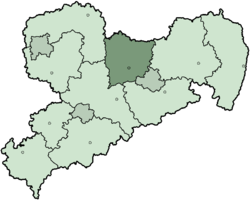
Meissen (German: Meißen) is a district (Kreis) in the Free State of Saxony, Germany. It is bounded by (from the north and clockwise) the state of Brandenburg, the district of Bautzen, the urban district Dresden, the districts Sächsische Schweiz-Osterzgebirge, Mittelsachsen and Nordsachsen.
History
The district dates back to the Amt Meißen, which was first mentioned in 1334. The district was ruled by the Wettin dynasty. The Margraves of what then became the Margravate of Meissen created the administrative division (Amt) in the 13th century. In 1835 the Amt was converted into an Amtshauptmannschaft, with the area of the current district covered by the Amtshauptmannschaften Meissen, Dresden and Großenhain. In 1939, these were renamed Landkreise (districts). In the administrative reform of 1952, several municipalities were transferred to the districts of Freiberg and Döbeln. In 1990, the old district borders were restored, and in 1996 parts of the district Dresden-Land were added. In August 2008 the district of Riesa-Großenhain was added to the district to give it its current size.
Geography
The main river of the district is the Elbe, which also flows through the city of Meissen.
Towns and municipalities
| Towns | Municipalities | |
|---|---|---|
References
External links
![]() Media related to County of Meissen at Wikimedia Commons
Media related to County of Meissen at Wikimedia Commons
- Official website (German)
- Inofficial website (German)
Coordinates: 51°13′N 13°31′E / 51.217°N 13.517°E
Towns and municipalities in Meissen (district) | ||
|---|---|---|
| Urban districts | |
|---|---|
| Rural districts | |
| Former urban districts | |
| Former rural districts | |