Melrand
| Melrand Mêlrant | ||
|---|---|---|
|
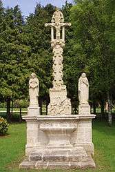
The Calvary of Melrand, on the road to Guémené-sur-Scorff | ||
| ||
 Melrand | ||
|
Location within Brittany region  Melrand | ||
| Coordinates: 47°58′52″N 3°06′37″W / 47.9811°N 3.1103°WCoordinates: 47°58′52″N 3°06′37″W / 47.9811°N 3.1103°W | ||
| Country | France | |
| Region | Brittany | |
| Department | Morbihan | |
| Arrondissement | Pontivy | |
| Canton | Baud | |
| Intercommunality | Pays de Baud | |
| Government | ||
| • Mayor (2008—2014) | Jean-Paul Pasco | |
| Area1 | 40.39 km2 (15.59 sq mi) | |
| Population (1999)2 | 1,525 | |
| • Density | 38/km2 (98/sq mi) | |
| Time zone | CET (UTC+1) | |
| • Summer (DST) | CEST (UTC+2) | |
| INSEE/Postal code | 56128 / 56310 | |
| Elevation | 32–161 m (105–528 ft) | |
|
1 French Land Register data, which excludes lakes, ponds, glaciers > 1 km² (0.386 sq mi or 247 acres) and river estuaries. 2 Population without double counting: residents of multiple communes (e.g., students and military personnel) only counted once. | ||
.svg.png)
Melrand (Breton: Mêlrant) is a commune in the Morbihan department of Brittany in north-western France.
Demographics
Inhabitants of Melrand are called in French Melrandais.
Breton language
In 2008, 31.4% of children in the commune attended schools taught in Breton and French for their primary education.[1]
Culture
Melrand is an example of a quintessential Bretagne town and includes traditional buildings of the region. It also has traditional fetes held in the centre of the town, often with traditional Bretagne dress.
See also
References
- ↑ (French) Ofis ar Brezhoneg: Enseignement bilingue
External links
| Wikimedia Commons has media related to Melrand. |
- Cultural Heritage (French)
- Map of Melrand on Michelin (English)
This article is issued from Wikipedia - version of the 9/18/2016. The text is available under the Creative Commons Attribution/Share Alike but additional terms may apply for the media files.