Menominee, Wisconsin
| Menominee, Wisconsin | |
|---|---|
| Town | |
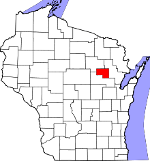 Location of the co-extensive Menominee County in Wisconsin | |
| Coordinates: 44°56′15″N 88°38′55″W / 44.93750°N 88.64861°WCoordinates: 44°56′15″N 88°38′55″W / 44.93750°N 88.64861°W | |
| Country | United States |
| State | Wisconsin |
| County | Menominee |
| Area | |
| • Total | 365.0 sq mi (945.3 km2) |
| • Land | 358.0 sq mi (927.1 km2) |
| • Water | 7.0 sq mi (18.2 km2) |
| Elevation[1] | 1,033 ft (315 m) |
| Population (2000) | |
| • Total | 4,562 |
| • Density | 12.7/sq mi (4.9/km2) |
| Time zone | Central (CST) (UTC-6) |
| • Summer (DST) | CDT (UTC-5) |
| Area code(s) | 715 & 534 |
| FIPS code | 55-50975[2] |
| GNIS feature ID | 1583694[1] |
| Website | http://www.co.menominee.wi.us/ (joint county/town website) |
For the city in western Wisconsin, see Menomonie.
Menominee is a town in Menominee County, Wisconsin, United States. The population was 4,562 at the 2000 census. The town of Menominee is co-extensive with Menominee County and the town and county governments are consolidated.[3]
Geography
According to the United States Census Bureau, the town has a total area of 365.0 square miles (945.3 km²), of which, 358.0 square miles (927.1 km²) of it is land and 7.0 square miles (18.2 km²) of it (1.93%) is water. It is the largest town in total area as well as land area in Wisconsin.
Around 1976, "the Indians of the Menominee Reservation separated from the Shawano-Gresham School District to open their own district," creating Menominee High School, which offers Menominee language, drumming, and tribal dance in addition to its academic program.[4]
Demographics
As of the census[2] of 2000, there were 4,562 people, 1,345 households, and 1,065 families residing in the town. The population density was 12.7 people per square mile (4.9/km²). There were 2,098 housing units at an average density of 5.9 per square mile (2.3/km²). The racial makeup of the town was 11.57% White, 0.07% African American, 87.26% Native American, 0.02% Pacific Islander, 0.33% from other races, and 0.75% from two or more races. Hispanic or Latino of any race were 2.67% of the population.
There were 1,345 households out of which 42.2% had children under the age of 18 living with them, 42.5% were married couples living together, 26.6% had a female householder with no husband present, and 20.8% were non-families. 16.5% of all households were made up of individuals and 6.4% had someone living alone who was 65 years of age or older. The average household size was 3.35 and the average family size was 3.66.
In the town the population was spread out with 38.9% under the age of 18, 8.4% from 18 to 24, 24.7% from 25 to 44, 19.5% from 45 to 64, and 8.5% who were 65 years of age or older. The median age was 28 years. For every 100 females there were 97.3 males. For every 100 females age 18 and over, there were 92.3 males.
The median income for a household in the town was $29,440, and the median income for a family was $28,385. Males had a median income of $22,683 versus $21,382 for females. The per capita income for the town was $10,625. About 24.8% of families and 28.8% of the population were below the poverty line, including 39.6% of those under age 18 and 13.4% of those age 65 or over.
Notable residents
References
- 1 2 "US Board on Geographic Names". United States Geological Survey. 2007-10-25. Retrieved 2008-01-31.
- 1 2 "American FactFinder". United States Census Bureau. Retrieved 2008-01-31.
- ↑ Wisconsin Legislative Reference Bureau. "Counties, Cities, Villages, Towns: Forms of Local Government and Their Functions", p. 2. "In fact, the entire county of Menominee is also one large town."
- ↑ O'Meara, Robery (1986-02-02). "Learning Language, Crafts Instills Pride in Students : Reservation Schools Keep Indian Tribe's Culture Alive". Los Angeles Times. Retrieved 2013-09-07.
External links
Municipalities and communities of Menominee County, Wisconsin, United States | ||
|---|---|---|
| Town | | |
| CDPs | ||
| Unincorporated community | ||
| Indian reservation | ||
| Ghost town | ||
| Footnotes | ‡This populated place also has portions in an adjacent county or counties | |