Milam, Hardy County, West Virginia
| Milam | |
|---|---|
| Unincorporated community | |
 Milam  Milam Location within the state of West Virginia | |
| Coordinates: 38°48′50″N 79°5′57″W / 38.81389°N 79.09917°WCoordinates: 38°48′50″N 79°5′57″W / 38.81389°N 79.09917°W | |
| Country | United States |
| State | West Virginia |
| County | Hardy |
| Elevation | 1,211 ft (369 m) |
| Time zone | Eastern (EST) (UTC-5) |
| • Summer (DST) | EDT (UTC-4) |
| GNIS feature ID | 1552093[1] |
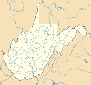
Milam is an unincorporated community on the South Fork South Branch Potomac River in southern Hardy County, West Virginia. Milam is located along County Route 7. Originally known as Wine Spring, the community's name was changed to Milam in 1898.
The community most likely was named after the local Milam family.[2]
References
- ↑ U.S. Geological Survey Geographic Names Information System: Milam, Hardy County, West Virginia
- ↑ Kenny, Hamill (1945). West Virginia Place Names: Their Origin and Meaning, Including the Nomenclature of the Streams and Mountains. Piedmont, WV: The Place Name Press. p. 414.
Municipalities and communities of Hardy County, West Virginia, United States | ||
|---|---|---|
| Towns | 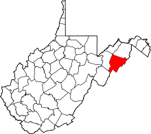 | |
| Unincorporated communities | ||
This article is issued from Wikipedia - version of the 7/28/2016. The text is available under the Creative Commons Attribution/Share Alike but additional terms may apply for the media files.