Mokwa
| Mokwa | |
|---|---|
| LGA and town | |
 Mokwa Location in Nigeria | |
| Coordinates: 9°12′N 5°20′E / 9.200°N 5.333°ECoordinates: 9°12′N 5°20′E / 9.200°N 5.333°E | |
| Country |
|
| State | Niger State |
| Government | |
| • Local Government Chairman and the Head of the Local Government Council | Adamu Mohammed Lwafu |
| Area | |
| • Total | 4,338 km2 (1,675 sq mi) |
| Population (2006 census) | |
| • Total | 244,937 |
| Time zone | WAT (UTC+1) |
| 3-digit postal code prefix | 912 |
| ISO 3166 code | NG.NI.MO |
Mokwa is a Local Government Area in Niger State, Nigeria. Its headquarters are in the town of Mokwa on the A1 highway in the west of the area.
The long southern border of the LGA is formed by the Niger River from Lake Jeba in the west beyond the confluence of the Kaduna River in the east. Kwara State and Kogi State are across the Niger from the LGA. The A1 highway crosses the Niger at Gana to Jebba in Kwara State.
It has an area of 4,338 km² and a population of 244,937 at the 2006 census.
The postal code of the area is 912.[1]
References
- ↑ "Post Offices- with map of LGA". NIPOST. Retrieved 2009-10-20.
State capital: Minna | ||
| LGAs | 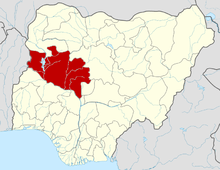 | |
This article is issued from Wikipedia - version of the 6/27/2015. The text is available under the Creative Commons Attribution/Share Alike but additional terms may apply for the media files.