Mariga, Nigeria
| Mariga Mamman A Umar Mariga Gada Biyu | |
|---|---|
| LGA and town | |
 Mariga Location in Nigeria | |
| Coordinates: 10°42′N 5°50′E / 10.700°N 5.833°ECoordinates: 10°42′N 5°50′E / 10.700°N 5.833°E | |
| Country |
|
| State | Niger State |
| Government | |
| • Local Government Chairman and the Head of the Local Government Council | Shehu Haruna |
| Area | |
| • Total | 5,552 km2 (2,144 sq mi) |
| Population (2006 census) | |
| • Total | 199,430 |
| Time zone | WAT (UTC+1) |
| 3-digit postal code prefix | 922 |
| ISO 3166 code | NG.NI.MR |
Mariga is a Local Government Area in Niger State, Nigeria. Its headquarters are in the town of Bangi in the north of the area. It has an area of 5,552 km² and a population of 199,430 at the 2006 census.[1]
The postal code of the area is 922.[2]
The LGA includes the Zugurma Game Reserve, a section of the Kainji National Park.[3]
References
- ↑ http://www.nigeriamasterweb.com/Nigeria06CensusFigs.html
- ↑ "Post Offices- with map of LGA". NIPOST. Retrieved 2009-10-20.
- ↑ "Kainji Lake National Park". United Nations Environment Programme: World Conservation Monitoring Centre. Retrieved 2010-10-21.
State capital: Minna | ||
| LGAs | 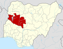 | |
This article is issued from Wikipedia - version of the 6/27/2015. The text is available under the Creative Commons Attribution/Share Alike but additional terms may apply for the media files.