Mongnawng State
This article is about the former Shan princely state. For the present-day administrative division, see Mong Nawng Township. For the town, see Mong Nawng.
| Mongnawng (Möngnawng) | |||||
| State of the Shan States | |||||
| |||||
 | |||||
| History | |||||
| • | Independence from Hsenwi State | 1851 | |||
| • | Abdication of the last Myoza | 1959 | |||
| Area | |||||
| • | 1901 | 4,079 km2 (1,575 sq mi) | |||
| Population | |||||
| • | 1901 | 39,102 | |||
| Density | 9.6 /km2 (24.8 /sq mi) | ||||
Mongnawng (also known as Möngnawng or Maingnaung) was a large Shan state in what is today Burma.
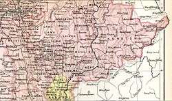
Mongnawng was bound by Kengtung State in the east. The Nam Pang, an important river, crossed the state from north to south. Its capital was Mong Nawng.[1]
History
Mongnawng became independent from Hsenwi in 1851 under the rulership of the myoza Heng Awn. It was a tributary of the Burmese Kingdom until 1887, when the Shan states submitted to British rule after the fall of the Konbaung dynasty.[2]
Rulers
The rulers of Mongnawng bore the title of Myoza.[3]
Myozas
- 1851 - 1866 Heng Awn (d. 1866)
- 1866 - 1868 Hkun Hkang (d. 1868)
- 1868 - 9 Aug 1906 Hkun Tun (b. 1858 - d. 1906)
- 9 Aug 1906 - 19.. Hkun Long (b. 1851 - d. 19..)
References
- ↑ "WHKMLA : History of the Shan States". 18 May 2010. Retrieved 21 December 2010.
- ↑ Imperial Gazetteer of India, v. 17, p. 408.
- ↑ Ben Cahoon (2000). "World Statesmen.org: Shan and Karenni States of Burma". Retrieved 7 July 2014.
Coordinates: 21°30′N 98°20′E / 21.500°N 98.333°E
This article is issued from Wikipedia - version of the 11/29/2015. The text is available under the Creative Commons Attribution/Share Alike but additional terms may apply for the media files.