Mongsit
| Mongsit State Möngsit | |||||
| State of the Shan States | |||||
| |||||
 | |||||
| Capital | Mongsit | ||||
| History | |||||
| • | State founded | 17th century | |||
| • | Abdication of the last Myoza | 1959 | |||
| Area | |||||
| • | 1901 | 784.76 km2 (303 sq mi) | |||
| Population | |||||
| • | 1901 | 9,013 | |||
| Density | 11.5 /km2 (29.7 /sq mi) | ||||
Mongsit or Möngsit (also known as Maingseik) was small state of the Shan States in what is today Burma.[1]
History
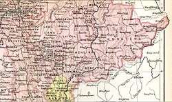
The capital and residence of the Myoza was Mongsit town, located in the northern part of the state and with 1,223 inhabitants according to the 1901 Census of India. The northern half of Mongsit was irrigated by the Nam Teng and the southern by the Nam Pawn[2]
Rulers
The rulers of Mongsit bore the title of Myoza.[3]
Myozas
- 1816 - 18.. ....
- 18.. - 1857 Sao Haw Pik
- 1857 - 18.. Hkun Kyaw San
- 18.. - 1873 Hkun Lu
- 1873 - 1876 Nang Li (f)
- 1873 - 1876 Hkam Yi -Regent (1st time)
- 1876 - 1880 Sao Leng Leong
- 1880 - 1883 Hkam Yi -Regent (2nd time)
- 1883 - .... Hkam Pwin (b. 1861 - d. ....)
References
- ↑ "WHKMLA : History of the Shan States". 18 May 2010. Retrieved 21 December 2010.
- ↑ Imperial Gazetteer of India, v. 17, p. 408.
- ↑ Ben Cahoon (2000). "World Statesmen.org: Shan and Karenni States of Burma". Retrieved 27 May 2016.
Coordinates: 20°33′N 98°37′E / 20.550°N 98.617°E
This article is issued from Wikipedia - version of the 5/29/2016. The text is available under the Creative Commons Attribution/Share Alike but additional terms may apply for the media files.