Montauk Avenue Historic District
|
Montauk Avenue Historic District | |
 | |
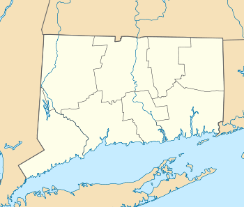  | |
| Location | Roughly bounded by Ocean, Willets and Riverview Avenues and Faire Harbor, New London, Connecticut |
|---|---|
| Coordinates | 41°20′20″N 72°6′22″W / 41.33889°N 72.10611°WCoordinates: 41°20′20″N 72°6′22″W / 41.33889°N 72.10611°W |
| Area | 62 acres (25 ha) |
| Architect | Multiple |
| Architectural style | Late 19th And 20th Century Revivals, Late Victorian |
| NRHP Reference # | 90001910[1] |
| Added to NRHP | December 18, 1990 |
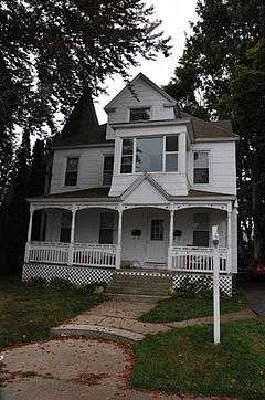
The Montauk Avenue Historic District encompasses a residential area of New London, Connecticut that was a planned subdivision developed in the early 20th century as a "streetcar suburb". The district consists of 341 buildings and was added to the National Register of Historic Places on December 18, 1990. The district's main thoroughfares are Montauk Avenue and Ocean Avenue, which roughly define its western and eastern bounds, and it includes small cross streets between Willetts Avenue and Fair Harbour Place. Most of the district's houses were built after 1895, and are wood frame structures in vernacular renditions of architectural revival styles popular in the early 20th century. Transitional forms between Queen Anne and other styles predominate. There are only four non-residential buildings in the district, all of which are masonry (either brick or stone): two schools, a church, and a fire station.[2]
See also
References
- ↑ National Park Service (2009-03-13). "National Register Information System". National Register of Historic Places. National Park Service.
- ↑ "NRHP nomination for Montauk Avenue Historic District" (PDF). National Park Service. Retrieved 2015-01-29.
| Topics | |
|---|---|
| Lists by states |
|
| Lists by insular areas | |
| Lists by associated states | |
| Other areas | |
| |