Montcléra
| Montcléra | |
|---|---|
|
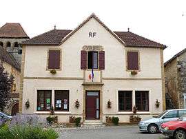
The town hall in Montcléra | |
 Montcléra | |
|
Location within Occitanie region  Montcléra | |
| Coordinates: 44°37′16″N 1°12′40″E / 44.6211°N 1.2111°ECoordinates: 44°37′16″N 1°12′40″E / 44.6211°N 1.2111°E | |
| Country | France |
| Region | Occitanie |
| Department | Lot |
| Arrondissement | Arrondissement of Cahors |
| Canton | Canton of Cazals |
| Intercommunality | Communauté de communes Sud Bouriane |
| Government | |
| • Mayor (2008–2014) | Jean-Claude Astorg |
| Area1 | 20.91 km2 (8.07 sq mi) |
| Population (1999)2 | 291 |
| • Density | 14/km2 (36/sq mi) |
| Time zone | CET (UTC+1) |
| • Summer (DST) | CEST (UTC+2) |
| INSEE/Postal code | 46200 / 46250 |
| Elevation |
154–311 m (505–1,020 ft) (avg. 239 m or 784 ft) |
|
1 French Land Register data, which excludes lakes, ponds, glaciers > 1 km² (0.386 sq mi or 247 acres) and river estuaries. 2 Population without double counting: residents of multiple communes (e.g., students and military personnel) only counted once. | |
Montcléra is a commune in the Lot department in south-western France.
See also
| Wikimedia Commons has media related to Montcléra. |
This article is issued from Wikipedia - version of the 3/28/2015. The text is available under the Creative Commons Attribution/Share Alike but additional terms may apply for the media files.