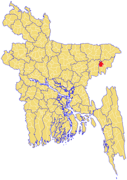
Moulvibazar Sadar Upazila
| Moulvibazar Sadar মৌলভীবাজার সদর | |
|---|---|
 | |
| Division | Sylhet Division |
| District | Moulvibazar District |
| Government | |
| • MP (Moulvibazar-3) | Vacant |
| Area | |
| • Total | 344.34 km2 (132.95 sq mi) |
| Population | |
| • Total | 239,378 |
| • Density | 700/km2 (1,800/sq mi) |
| Time zone | BST (UTC+6) |
| Postal code | 3200 |
Moulvibazar Sadar (Bengali: মৌলভীবাজার সদর) is an Upazila of Moulvibazar District[1] in the Division of Sylhet, Bangladesh.
Geography
Moulvibazar Sadar is located at 24°28′40″N 91°46′00″E / 24.4778°N 91.7667°E. It has 40573 households and total area 344.34 km².
Union Parishads
The upazila has 12 Union Parishads or UPs. They are as follow:
- Akhailkura
- Amtail
- Chandnighat
- Ekatuna
- Giasnagar
- Kamalpur
- Kanakpur
- Khalilpur
- Manumukh
- Mostafapur
- Nazirabad
- Kagabala
Demographics
As of the 1991 Bangladesh census, Moulvibazar Sadar has a population of 239378. Males constitute 51.56% of the population, and females 48.44%. This Upazila's eighteen up population is 126303. Moulvibazar Sadar has an average literacy rate of 36.1% (7+ years), and the national average of 32.4% literate.[2]
Administration
Moulvibazar Sadar has 12 Unions/Wards, 229 Mauzas/Mahallas, and 419 villages. Moulvibazar Govt. High School is the oldest one in the district
Education
According to Banglapedia, Ali Amzad Government Girls' High School, founded in 1932, is a notable secondary school.[1]
See also
References
- 1 2 Wadud, Shah Abdul (2012). "Maulvibazar Sadar Upazila". In Islam, Sirajul; Jamal, Ahmed A. Banglapedia: National Encyclopedia of Bangladesh (Second ed.). Asiatic Society of Bangladesh.
- ↑ "Population Census Wing, BBS.". Archived from the original on 2005-03-27. Retrieved November 10, 2006.
| Upazila/Thana: | ||
|---|---|---|