Rajnagar Upazila
| Rajnagar রাজনগর | |
|---|---|
 | |
| Division | Sylhet Division |
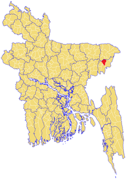
| District | Moulvibazar District |
| Government | |
| • MP (Moulvibazar-3) | Soyeda Saira Mohsin,MP/এমপি (Bangladesh Awami League .) |
| Area | |
| • Total | 338.15 km2 (130.56 sq mi) |
| Population | |
| • Total | 174,280 |
| • Density | 515/km2 (1,330/sq mi) |
| Time zone | BST (UTC+6) |
| Postal code | 3240 |
See Rajnagar for disambiguation
Raj Nagar (Bengali: রাজনগর) is an Upazila of the Moulvibazar District[1] in the Division of Sylhet, Bangladesh. The district has roughly 29,300 houses and an area of approximately 340 km². There are three well-known rivers which flow across the Upazila border side of Rajnagar: the Kushiara in the North, the Manu across the southern three unions (Kamarchak, Tengrabazar, and Mansurnager), and the Dholai across Kamarchak and the southern border.
Etymology
The name of the city, Rajnagar is derived from two words, Raj and nagar, meaning "City of the King".
Demographics
As of the 2011 Bangladesh Census, Rajnagar's population was 232,666, with 113,149 males and 119,517 females. The religious make-up is 180,566 Muslims, 51,867 Hindus, 4 Buddhists, 133 Christians, and 92 people of other religions. This Upazila's over-18 population is about 100,000. Rajnagar has an average literacy rate of 48.6%, above the national average of 42.4%.[2]
Administration
Rajnagar has 8 Unions (Fatehpur, Uttarbhag, Munshibazar, Panch goan, Rajnager, Tengrabazar, Kamarchak, and Monsurnager), 149 Mauzas/Mahallas, and 255 villages. Rajnagar contains many tea gardens and historical places. The first Upazila Chairman Freedom Fighter Rana Choudhury is the founder of Rajnagar Degree College (Principal Abdul Ahad Choudhury founded the college in 1982); Major General Abdu Rab is the co-founder of that college. The present Upazila Chairman is Freedom Fighter Md. Askir Khan of the Ruling Party Awamileague. For the last two terms Md. Misbahuduzza (Velai) of Awamileague has been the Upazila Chairman of Rajnagar. Munshibazar is one of the most important commercial unions in this Upazila due to the large number of goods and services. The tea gardens produce plenty of different types of tea and fruit as well. A list of important figures in Munshibazar is given below.
- Eng. Syed Golam Sarwar, Ex-Superintendent Engineer, DPHE, BANGLADESH
- Dr. Syed Sharmin Sarwar, Assistant Professor, Osmani Medical college, Sylhet, Bangladesh.
- Mr. Mohtossir Ali, Educationalist
- Syed Golam Shahjarul Alam, Deputy Director, Bangladesh Bank
KAMARCHAK UNION : The Kamarchak Union is the most famous of the eight unions, as many well-known people were born and still live in the region. Most of the people are peaceful, progressive and creative . The union consists of 44 villages and does substantial business through foreign exchange earned by man-power exported in different countries in the World . In 1971, during the freedom fighting, Kamarchak was one of the most advantageous place and safe heaven for freedom fighters. Fighters under Kazi Jafor Ahmed, ex-Prime Minister of the Jatiya Party government,Organized and fought from this union. Kamarchak is almost surrounded by two rivers - the Manu to the north and the Dholai across (which is crisscrossed by the Udna and the Palki, two smaller rivers). Very often, this union becomes affected by floods but produces plenty of paddy, sugarcane, and vegetables. River erosion, flooding, a poor communications infrastructure, and a low literacy rate are the four main problems. The "Vishnu Pod" Dham (named after the Foot Sign of God Vishnu), one of the sacred places of the Hindus, is situated half a kilometer away,to the east of Tarapasha Bazar. Tarapasha High School, (now a high school and college) founded in 1932 on the donated estate of the Nag family, is one of the oldest educational institutions in Rajnagar. The founding headmaster of this school was late Md. Rezawar Khan, a very respected educator. There is a Branch of Bangladesh Sonali Bank since three decades.
See also
References
- ↑ Shah Md. Muizur Rahman (2012), "Rajnagar Upazila", in Sirajul Islam and Ahmed A. Jamal, Banglapedia: National Encyclopedia of Bangladesh (Second ed.), Asiatic Society of Bangladesh
- ↑ "Population Census Wing, BBS.". Archived from the original on 2005-03-27. Retrieved November 10, 2006.
| Upazila/Thana: | ||
|---|---|---|
Capital: Sylhet | ||
| Habiganj District |  | |
| Moulvibazar District | ||
| Sunamganj District | ||
| Sylhet District | ||