Munroe Falls, Ohio
| Munroe Falls, Ohio | ||
|---|---|---|
| City | ||
|
Munroe Falls City Hall | ||
| ||
| Motto: "A Great Place to Call Home" | ||
 Location in Summit County and the state of Ohio. | ||
| Coordinates: 41°8′40″N 81°26′23″W / 41.14444°N 81.43972°WCoordinates: 41°8′40″N 81°26′23″W / 41.14444°N 81.43972°W | ||
| Country |
| |
| State |
| |
| County | Summit | |
| Founded | 1838 | |
| Government | ||
| • Mayor | James Armstrong | |
| Area[1] | ||
| • Total | 7.28 km2 (2.81 sq mi) | |
| • Land | 7.04 km2 (2.72 sq mi) | |
| • Water | 0.23 km2 (0.09 sq mi) | |
| Elevation | 314 m (1,030 ft) | |
| Population (2010)[2] | ||
| • Total | 5,012 | |
| • Estimate (2012[3]) | 4,994 | |
| • Density | 711.4/km2 (1,842.6/sq mi) | |
| Time zone | EST (UTC-5) | |
| • Summer (DST) | EDT (UTC-4) | |
| ZIP code | 44262 | |
| Area code(s) | 330, 234 | |
| FIPS code | 39-53312[4] | |
| GNIS feature ID | 1065085[5] | |
| Website |
munroefalls | |

.jpg)
Munroe Falls is a city in the east-central portion of Summit County, Ohio, United States, between Stow and Tallmadge. It is a suburb of Akron and is part of the Akron Metropolitan Statistical Area. The population was 5,012 at the 2010 census.
History
Like much of the Connecticut Western Reserve, the area that makes up present-day Munroe Falls was previously inhabited by various tribes of American Indians.[6] When the Western Reserve began being surveyed in 1796, what is now Munroe Falls was mostly in the southern part of the survey township Town 3, Range 10 (later to be Stow Township), then a part of Washington County before being placed in the new Jefferson County the following year. In 1800, it was made part of Trumbull County, which followed the boundaries of the Western Reserve, and in 1808, the area was made part of Portage County.[7] The first settlers in present-day Munroe Falls, a group of around 40 people including Francis Kelsey and William Stow, came in 1809.[8] Kelsey built a sawmill on the south side of the Cuyahoga River and a gristmill was built on the north side.[9] The initial name of the new village was Kelsey's Mills (also Kelsey Mills). The first school in Munroe Falls was built in 1816.[10] In 1817 a wooden dam was built to provide power for both mills and the name of the village was changed to Florence.[11] Around 1836, William and Edmund Munroe (also spelled Monroe) from Boston arrived and purchased the two mills and approximately 250 acres (101 ha) of land around them to lay out a new village, which they named Munroe Falls.[9] The village was incorporated October 26, 1838.[12] The Munroes had great plans for the village to become a center of commerce and an important city, but these plans never worked out. After about 10 years, which included the economic instability of the Panic of 1837,[8] the Munroes defaulted to many of the creditors and the properties they owned were taken over by other individuals.[9]
The Pennsylvania and Ohio Canal opened in 1840 and passed through Munroe Falls, the first boats landing on August 6 of that year arriving from New Castle, Pennsylvania.[13] It closed around 1870.[14] Also in 1840, Munroe Falls was made part of the new Summit County.[15] In 1866, the old gristmill was purchased by the Cleveland Paper Company and refitted for paper manufacturing. The building burned down approximately 1–2 years later and the present factory - today owned by Sonoco Products - was built on the same site.[9] In 1884 railroad tracks were laid in the former canal bed as part of a single line owned by the Pittsburgh and Western Railroad.[16] These tracks were doubled in 1900 following the purchase of the railroad by Baltimore and Ohio Railroad.
The village got a new town hall in the 1960s. This building, which continues to serve as City Hall, was constructed in 1885 to serve as the Munroe Falls Schoolhouse, serving its original purpose until 1916.[17]
In 1921 the community applied for and was granted village status. This action was taken in order to avoid becoming a part of neighboring Stow, which was applying for similar status and had included sections of Munroe Falls in its application. Finding that as a village there was not enough population to maintain self-sufficiency, the village held city officer elections for the first time in 1925 in order to revoke the village charter and receive county services.[18]
Munroe Falls converted to city status in 1991.[10]
In the early 2000s, the Ohio Environmental Protection Agency (EPA) and Summit County determined that the oxygen levels were too low in the Cuyahoga River, due mostly to the stagnant pool behind the Munroe Falls dam.[19] The solution was to lower the dam, which dated to 1903.[11] Eventually, the entire dam was removed after workers discovered a natural ledge underneath the existing dam. This project, begun in August 2005 and completed in October 2006, was part of a larger project along much of the river in the city that included cleanup and restoration.[20]
Munroe Falls is also home to SGS Tool Company, the worlds’ largest manufacture of round solid carbide cutting tools. SGS Tool Company’s corporate headquarters and R&D centers are located in Munroe Falls, while their manufacturing operations are located in Cuyahoga Falls. SGS is the largest employer in Munroe Falls, and is the largest percentage of the corporate tax base.
Geography
Munroe Falls is located in eastern Summit County adjacent to the cities of Stow to the north, Tallmadge to the south, and Cuyahoga Falls to the west with the village of Silver Lake on the northwest. It was formed from parts of the now-defunct Stow and Tallmadge townships.
According to the United States Census Bureau, the city has a total area of 2.81 square miles (7.28 km2), of which 2.72 square miles (7.04 km2) is land and 0.09 square miles (0.23 km2) is water.[1]
Demographics
| Historical population | |||
|---|---|---|---|
| Census | Pop. | %± | |
| 1930 | 302 | — | |
| 1940 | 511 | 69.2% | |
| 1950 | 933 | 82.6% | |
| 1960 | 1,828 | 95.9% | |
| 1970 | 3,794 | 107.5% | |
| 1980 | 4,731 | 24.7% | |
| 1990 | 5,359 | 13.3% | |
| 2000 | 5,314 | −0.8% | |
| 2010 | 5,012 | −5.7% | |
| Est. 2015 | 5,019 | [21] | 0.1% |
| Sources:[22][23][24][4][25] | |||
2010 census
As of the census[2] of 2010, there were 5,012 people, 2,086 households, and 1,467 families residing in the city. The population density was 1,842.6 inhabitants per square mile (711.4/km2). There were 2,189 housing units at an average density of 804.8 per square mile (310.7/km2). The racial makeup of the city was 95.6% White, 1.5% African American, 0.1% Native American, 1.4% Asian, 0.2% from other races, and 1.2% from two or more races. Hispanic or Latino of any race were 1.2% of the population.
There were 2,086 households of which 27.0% had children under the age of 18 living with them, 58.1% were married couples living together, 8.5% had a female householder with no husband present, 3.7% had a male householder with no wife present, and 29.7% were non-families. 25.2% of all households were made up of individuals and 10.2% had someone living alone who was 65 years of age or older. The average household size was 2.40 and the average family size was 2.87.
The median age in the city was 45.1 years. 20.2% of residents were under the age of 18; 7.2% were between the ages of 18 and 24; 22.3% were from 25 to 44; 33.8% were from 45 to 64; and 16.3% were 65 years of age or older. The gender makeup of the city was 48.7% male and 51.3% female.
Of the city's population over the age of 25, 42.0% hold a bachelor's degree or higher.[26]
2000 census
As of the census[4] of 2000, there were 5,314 people, 1,955 households, and 1,524 families residing in the city. The population density was 1,939.8 people per square mile (748.8/km²). There were 2,035 housing units at an average density of 742.9 per square mile (286.8/km²). The racial makeup of the city was 97.10% White, 0.92% African American, 0.02% Native American, 1.19% Asian, 0.06% Pacific Islander, 0.09% from other races, and 0.62% from two or more races. Hispanic or Latino of any race were 0.70% of the population.
There were 1,955 households out of which 35.0% had children under the age of 18 living with them, 68.7% were married couples living together, 6.7% had a female householder with no husband present, and 22.0% were non-families. 18.8% of all households were made up of individuals and 6.3% had someone living alone who was 65 years of age or older. The average household size was 2.66 and the average family size was 3.04.
In the city the population was spread out with 24.6% under the age of 18, 6.4% from 18 to 24, 25.6% from 25 to 44, 29.8% from 45 to 64, and 13.6% who were 65 years of age or older. The median age was 41 years. For every 100 females there were 94.4 males. For every 100 females age 18 and over, there were 91.8 males.
The median income for a household in the city was $61,169, and the median income for a family was $69,918. Males had a median income of $51,277 versus $31,563 for females. The per capita income for the city was $27,317. About 0.3% of families and 1.5% of the population were below the poverty line, including 0.8% of those under age 18 and 0.8% of those age 65 or over.
Education
Munroe Falls is primarily served by the Stow-Munroe Falls City School District.[27] Serving more than 5,700 students, the district operates six elementary schools (Echo Hills, Fishcreek, Highland, Indian Trail, Riverview and Woodland), Lakeview Intermediate School, Kimpton Middle School and Stow-Munroe Falls High School. Riverview Elementary and Kimpton Middle School are located in Munroe Falls, while the remainder of the district's facilities are located in Stow.[28] A small portion of Munroe Falls is part of the neighboring Tallmadge school district.[27]
Parks and Recreation
There are 3 main MetroParks in Munroe Falls. There is the Munroe Falls Swimming Lake, the Bike and Hike and Tallmadge Meadows. All three parks are off Route 91. [29]
Notable people
- John Magaro - actor[30]
- Richard Myers - independent/experimental filmmaker
References
- 1 2 "US Gazetteer files 2010". United States Census Bureau. Retrieved 2013-01-06.
- 1 2 "American FactFinder". United States Census Bureau. Retrieved 2013-01-06.
- ↑ "Population Estimates". United States Census Bureau. Retrieved 2013-06-17.
- 1 2 3 "American FactFinder". United States Census Bureau. Retrieved 2008-01-31.
- ↑ "US Board on Geographic Names". United States Geological Survey. 2007-10-25. Retrieved 2008-01-31.
- ↑ Perrin, William Henry, ed. (1881). History of Summit County (1972 ed.). Chicago, Illinois (1881); Indianapolis, Indiana (1972): Baskin & Balley (1881); Unigraphic (1972). pp. 207–225.
- ↑ "Ohio County Formation Maps". genealogyinc.com. Genealogy Inc. 2008. Retrieved 28 September 2009.
- 1 2 "Early History Munroe Falls". SMFPL.org. Stow-Munroe Falls Public Library. Retrieved 12 October 2009. Adapted from Fifty Years and Over Of Akron and Summit County by Samuel A. Lane (1892)
- 1 2 3 4 Perrin, pp 516-518
- 1 2 Daugherty, Beth E. (2010). Images of America: Stow and Munroe Falls. Arcadia Publishing. pp. 7–8. ISBN 978-0-7385-8388-4.
- 1 2 "History". Munroe Falls Dam: Changing a Dam, Restoring a River. County of Summit. 2008. Retrieved 27 September 2009.
In 1809, an estimated 40 people traveled from Connecticut and settled next to a river called the Cuyahoga. The settlers called their new village Kelsey's Mills. ... The first report of a dam in Munroe Falls was 1817, the same year that the name of the village was changed to Florence.
- ↑ "Sights to See in Monroe Falls". SummitHistory.org. Summit County Historical Society. 2007. Retrieved 28 September 2009.
- ↑ Daugherty, Beth E. (2010). Images of America: Stow and Munroe Falls. Arcadia Publishing. p. 14. ISBN 978-0-7385-8388-4.
- ↑ Adkins, Wendy J. (1997). "Penn & Ohio". Archived from the original on 2009-10-26. Retrieved 28 September 2009.
- ↑ Perrin, p. 229
- ↑ "Timeline". Stow.Oh.Us. City of Stow. 2008. Retrieved 28 September 2009.
- ↑ Daugherty, Beth E. (2010). Images of America: Stow and Munroe Falls. Arcadia Publishing. p. 119. ISBN 978-0-7385-8388-4.
- ↑ "They'll Be First and Last Officials at Munroe Falls". The Akron Sunday Times. Akron, Ohio. September 13, 1925. p. 3.
- ↑ "Problem and Solution". Munroe Falls Dam: Changing a Dam, Restoring a River. County of Summit. 2008. Retrieved 28 September 2009.
- ↑ "Removing the Munroe Falls Dam". Munroe Falls Dam: Changing a Dam, Restoring a River. County of Summit. 2008. Retrieved 28 September 2009.
- ↑ "Annual Estimates of the Resident Population for Incorporated Places: April 1, 2010 to July 1, 2015". Retrieved July 2, 2016.
- ↑ "Population: Ohio" (PDF). 1930 US Census. U.S. Census Bureau. Retrieved 28 November 2013.
- ↑ "Number of Inhabitants: Ohio" (PDF). 18th Census of the United States. U.S. Census Bureau. Retrieved 22 November 2013.
- ↑ "Ohio: Population and Housing Unit Counts" (PDF). U.S. Census Bureau. Retrieved 22 November 2013.
- ↑ "Incorporated Places and Minor Civil Divisions Datasets: Subcounty Population Estimates: April 1, 2010 to July 1, 2012". U.S. Census Bureau. Retrieved 25 November 2013.
- ↑ http://quickfacts.census.gov/qfd/states/39/3953312.html
- 1 2 Exner, Rich (January 13, 2009). "Northeast Ohio property tax rates, and where the money goes". Cleveland.com. Cleveland Live, Inc. Retrieved August 6, 2010.
- ↑ "Stow-Munroe Falls City School District". SMFSchools.org. Stow-Munroe Falls City School District. 2010. Retrieved August 6, 2010.
- ↑ Summit Metro Parks
- ↑ Heldenfels, Rich (October 8, 2010). "Slasher film star chases after dream: Stow grad John Magaro carves out acting career, stars in Wes Craven flick". Akron Beacon Journal. Beacon Journal Publishing Co.
External links
| Wikimedia Commons has media related to Munroe Falls, Ohio. |
- City of Munroe Falls
- Stow-Munroe Falls Chamber of Commerce
- Munroe Falls Historical Society
- SummitMemory.org: Images from the Munroe Falls Historical Society
Municipalities and communities of Summit County, Ohio, United States | ||
|---|---|---|
| Cities | 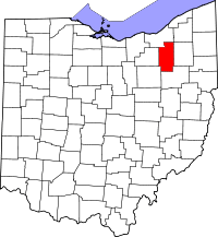 | |
| Villages | ||
| Townships | ||
| CDPs | ||
| Unincorporated communities | ||
| Footnotes | ‡This populated place also has portions in an adjacent county or counties | |