Mur de Péguère
| Mur de Péguère | |
|---|---|
 | |
| Elevation | 1,375 m (4,511 ft)[1] |
| Traversed by | D17 |
| Location | Ariège, France |
| Range | Pyrenees |
| Coordinates | 42°55′06″N 1°23′21″E / 42.91833°N 1.38917°ECoordinates: 42°55′06″N 1°23′21″E / 42.91833°N 1.38917°E |
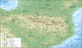 Mur de Péguère Location of Mur de Péguère | |
The Mur de Péguère (also known as the Col de Péguère) (elevation 1,375 m (4,511 ft)) is a mountain pass in the French Pyrenees in the department of Ariège, between the communities of Massat (south) and Sentenac-de-Sérou (north).
Details of climb
From Massat, the climb initially follows the D618 towards the Col de Port before turning onto the D17 just after the Col des Caougnous. The total ascent is 9.8 km (6.1 mi) long, with a height gained of 726 m (2,382 ft) at an average gradient of 7.4%, with the section after the Col des Caougnous having stretches in excess of 18%.[2][3]
From the Foix direction, the ascent starts at La Mouline (Serres-sur-Arget) from where the climb is 18 km (11 mi), gaining 872 m (2,861 ft), in height at an average gradient of 4.8%.[4] The col can also be reached on the descent from the Col de Portel.[5]
Tour de France
The pass was crossed in Stage 14 of the 2012 Tour de France from the Massat direction.[6] The leader over the summit was French rider, Sandy Casar,[3] although the stage was marred when tacks were thrown onto the road at the summit of the climb, causing as many as thirty riders to puncture.[7][8]
In 1973, the summit was scheduled to be climbed from the Foix direction,[6] but the riders protested that the descent towards the D618 was too dangerous, so the route was amended. Since 1973, the road has been resurfaced.[9]
The col was also crossed on Stage 11 in 2008, on the descent from the Col de Portel, but was not categorised.[10]
References
- ↑ IGN map
- ↑ "Col de Péguère: Massat". www.climbbybike.com. Retrieved 29 June 2012.
- 1 2 "Le Mur de Péguère dans le Tour de France" (in French). ledicodutour. Retrieved 16 July 2012.
- ↑ "Col de Péguère: La Mouline". www.climbbybike.com. Retrieved 29 June 2012.
- ↑ "Col de Péguère: Col Crouzette". www.climbbybike.com. Retrieved 29 June 2012.
- 1 2 "Mountain passes & Hills: Stage 14". Tour de France. Amaury Sport Organisation. Retrieved 28 June 2012.
- ↑ Beaudin, Matthew (15 July 2012). ""Idiots" scatter tacks on Mur de Peguere, causing dozens of flats". VeloNews. Competitor Group, Inc. Retrieved 15 July 2012.
- ↑ Atkins, Ben (15 July 2012). "Bradley Wiggins: "No one wants to benefit from someone else's misfortune"". VeloNation. VeloNation LLC. Retrieved 15 July 2012.
- ↑ "July 15, Stage 14: Limoux – Foix 191km". Cycling News. Future Publishing Limited. 23 June 2012. Retrieved 29 June 2012.
- ↑ "Stage 11 - Lannemezan to Foix". Tour de France 2008. Amaury Sport Organisation. 16 July 2008. Retrieved 29 June 2012.